MyTopo
Muenster East Texas US Topo Map
Couldn't load pickup availability
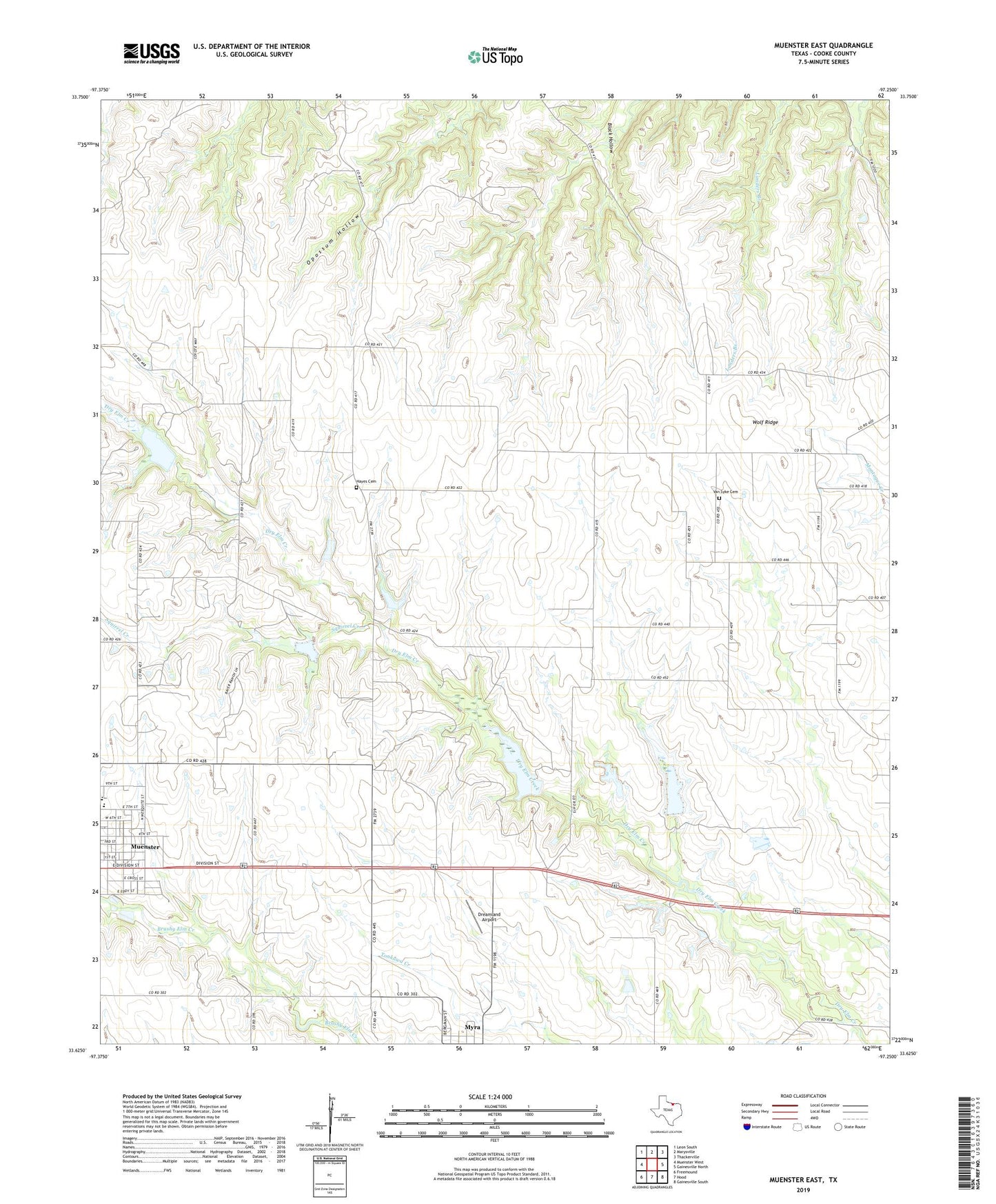
2022 topographic map quadrangle Muenster East in the state of Texas. Scale: 1:24000. Based on the newly updated USGS 7.5' US Topo map series, this map is in the following counties: Cooke. The map contains contour data, water features, and other items you are used to seeing on USGS maps, but also has updated roads and other features. This is the next generation of topographic maps. Printed on high-quality waterproof paper with UV fade-resistant inks.
Quads adjacent to this one:
West: Muenster West
Northwest: Leon South
North: Marysville
Northeast: Thackerville
East: Gainesville North
Southeast: Gainesville South
South: Hood
Southwest: Freemound
This map covers the same area as the classic USGS quad with code o33097f3.
Contains the following named places: Dreamland Airport, Hayes Cemetery, KXGM-FM (Muenster), Muenster Division, Muenster Elementary School, Muenster High School, Muenster High School Football Stadium, Sacred Heart High School Football Field, Soil Conservation Service Site 7a Dam, Soil Conservation Service Site 7a Reservoir, Soil Conservation Service Site 7b Dam, Soil Conservation Service Site 7b Reservoir, Soil Conservation Service Site 7c Dam, Soil Conservation Service Site 7c Reservoir, Soil Conservation Service Site 7d Dam, Soil Conservation Service Site 7d Reservoir, Soil Conservation Service Site 7f Dam, Soil Conservation Service Site 7f Reservoir, Soil Conservation Service Site 7g Dam, Soil Conservation Service Site 7g Reservoir, Squirrel Creek, Van Syke Cemetery, Wolf Ridge