MyTopo
Hood Texas US Topo Map
Couldn't load pickup availability
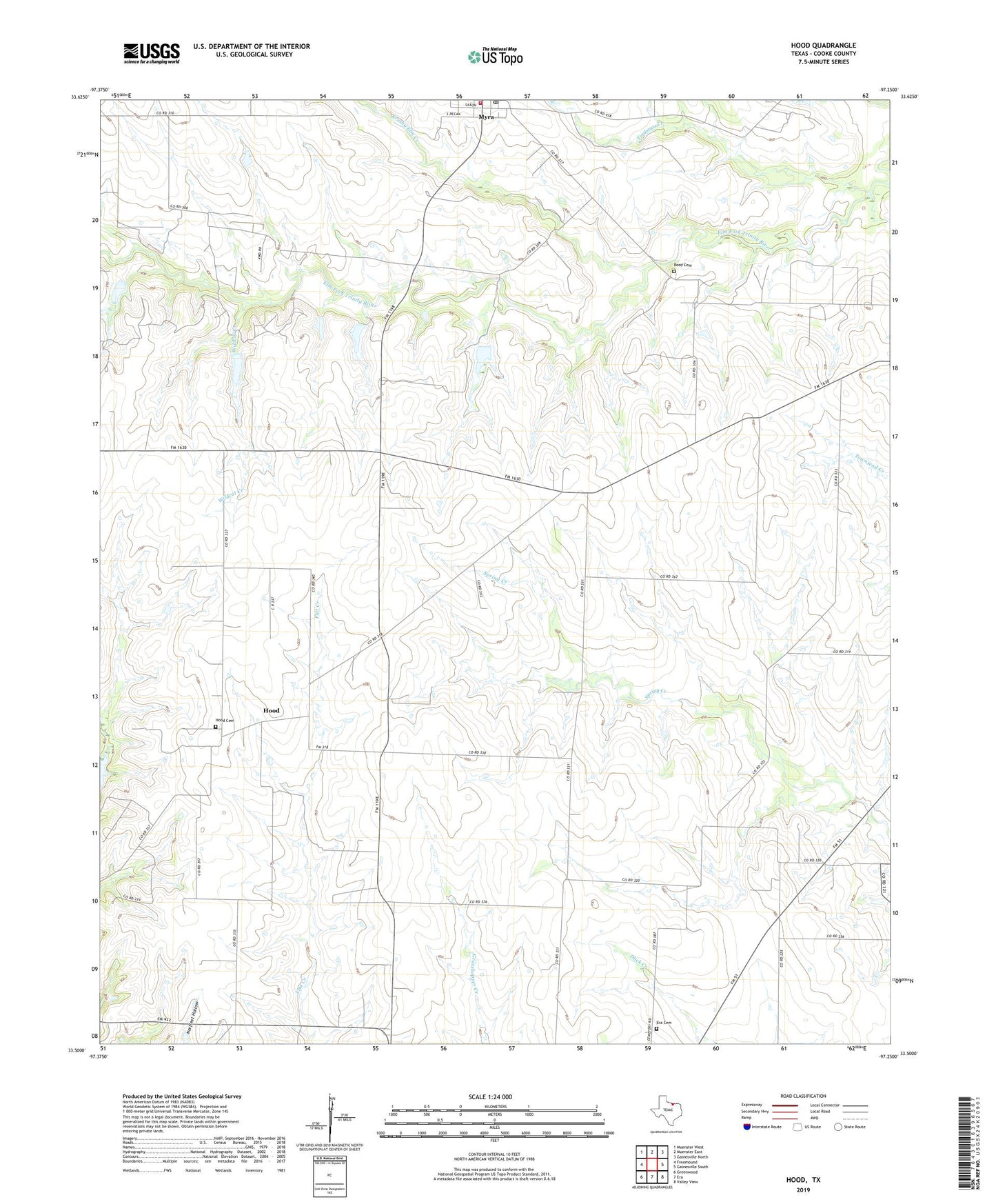
2022 topographic map quadrangle Hood in the state of Texas. Scale: 1:24000. Based on the newly updated USGS 7.5' US Topo map series, this map is in the following counties: Cooke. The map contains contour data, water features, and other items you are used to seeing on USGS maps, but also has updated roads and other features. This is the next generation of topographic maps. Printed on high-quality waterproof paper with UV fade-resistant inks.
Quads adjacent to this one:
West: Freemound
Northwest: Muenster West
North: Muenster East
Northeast: Gainesville North
East: Gainesville South
Southeast: Valley View
South: Era
Southwest: Greenwood
This map covers the same area as the classic USGS quad with code o33097e3.
Contains the following named places: Brewer Oil Field, Brushy Elm Creek, Burleson Public Library, Ellenburger Oil Field, Era Cemetery, Gruber Oil Field, Hood, Hood Cemetery, Myra, Myra Census Designated Place, Myra Remotely Managed Post Office, Myra Volunteer Fire Department, Reed Cemetery, Soil Conservation Service Site 61k Dam, Soil Conservation Service Site 61k Reservoir, Soil Conservation Service Site 61l Dam, Soil Conservation Service Site 61l Reservoir, Soil Conservation Service Site 6i Dam, Soil Conservation Service Site 6i Reservoir, Soil Conservation Service Site 6j2 Dam, Soil Conservation Service Site 6j2 Reservoir, Soil Conservation Service Site 6k2 Dam, Soil Conservation Service Site 6k2 Reservoir, Soil Conservation Service Site 6l Dam, Soil Conservation Service Site 6l Reservoir, Tonkawa Creek, Valley View Division, Wildcat Creek, ZIP Code: 76253