
MyTopo
Ganado Texas US Topo Map
Couldn't load pickup availability
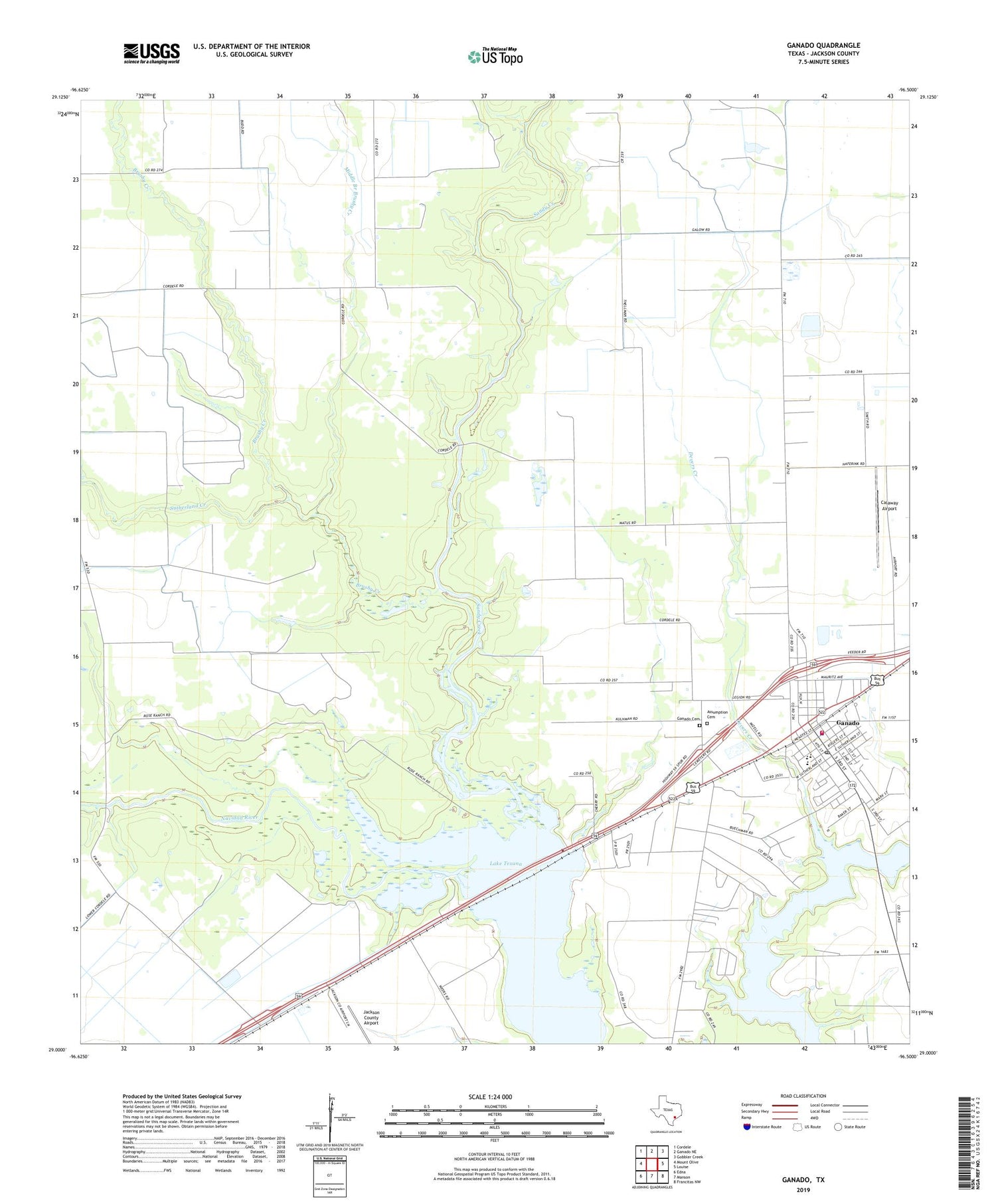
2019 topographic map quadrangle Ganado in the state of Texas. Scale: 1:24000. Based on the newly updated USGS 7.5' US Topo map series, this map is in the following counties: Jackson. The map contains contour data, water features, and other items you are used to seeing on USGS maps, but also has updated roads and other features. This is the next generation of topographic maps. Printed on high-quality waterproof paper with UV fade-resistant inks.
Quads adjacent to this one:
West: Mount Olive
Northwest: Cordele
North: Ganado NE
Northeast: Gobbler Creek
East: Louise
Southeast: Francitas NW
South: Manson
Southwest: Edna
Contains the following named places: Assumption Cemetery, Brushy Creek, Calaway Airport, City of Ganado, Devers Creek, Ganado, Ganado Cemetery, Ganado City Hall, Ganado Community Cemetery, Ganado Elementary School, Ganado Emergency Medical Service, Ganado High School, Ganado Police Department, Ganado Post Office, Ganado Volunteer Fire Department, Ganado West Oil Field, Jackson County Airport, Jackson County Constable's Office Precinct 2, Jaycee Park, Middle Branch Brushy Creek, Sandy Creek, Sandy Creek Oil Field, Sutherland Creek


