MyTopo
Manson Texas US Topo Map
Couldn't load pickup availability
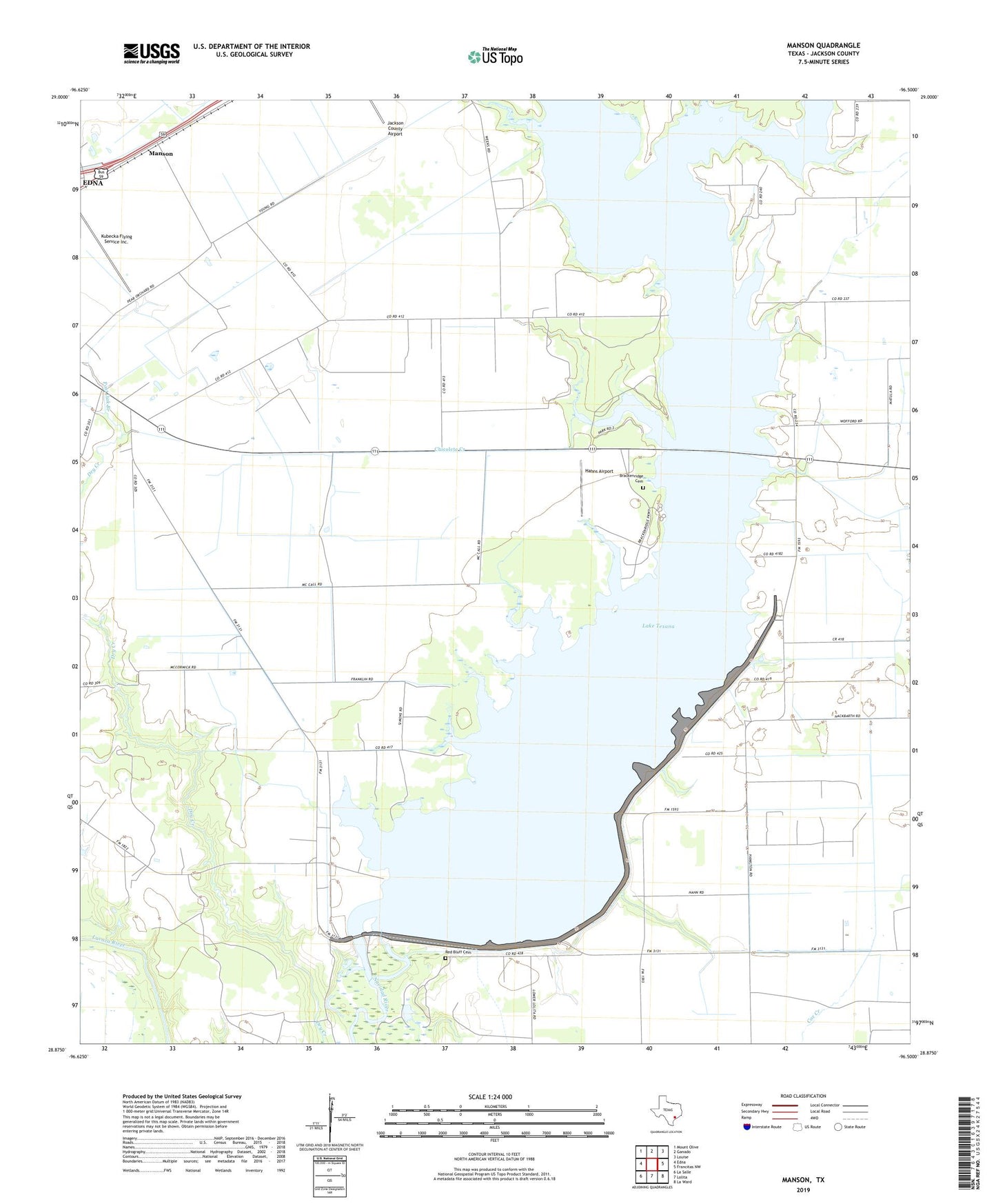
2022 topographic map quadrangle Manson in the state of Texas. Scale: 1:24000. Based on the newly updated USGS 7.5' US Topo map series, this map is in the following counties: Jackson. The map contains contour data, water features, and other items you are used to seeing on USGS maps, but also has updated roads and other features. This is the next generation of topographic maps. Printed on high-quality waterproof paper with UV fade-resistant inks.
Quads adjacent to this one:
West: Edna
Northwest: Mount Olive
North: Ganado
Northeast: Louise
East: Francitas NW
Southeast: La Ward
South: Lolita
Southwest: La Salle
This map covers the same area as the classic USGS quad with code o28096h5.
Contains the following named places: Brackenridge Cemetery, Brackenridge Plantation Recreation Area, Hahns Airport, Jackson County, Lake Texana, Lake Texana State Park, Lake Texana State Park Trail, Manson, Mustang Creek, Post Oak Branch, Red Bluff, Red Bluff Cemetery, Red Bluff Church, Texana Oil Field