MyTopo
Mount Olive Texas US Topo Map
Couldn't load pickup availability
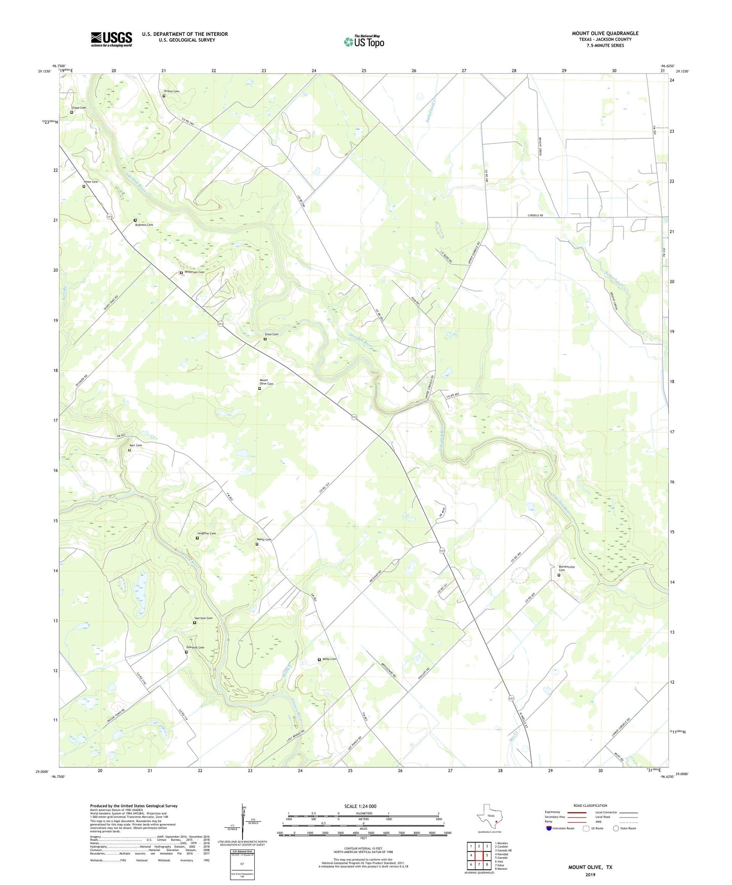
2022 topographic map quadrangle Mount Olive in the state of Texas. Scale: 1:24000. Based on the newly updated USGS 7.5' US Topo map series, this map is in the following counties: Jackson. The map contains contour data, water features, and other items you are used to seeing on USGS maps, but also has updated roads and other features. This is the next generation of topographic maps. Printed on high-quality waterproof paper with UV fade-resistant inks.
Quads adjacent to this one:
West: Navidad
Northwest: Morales
North: Cordele
Northeast: Ganado NE
East: Ganado
Southeast: Manson
South: Edna
Southwest: Inez
This map covers the same area as the classic USGS quad with code o29096a6.
Contains the following named places: Andrews Cemetery, Burnettville Cemetery, Chase Cemetery, Collier Oil Field, Cordele Oil Field, Edna-Cordele Division, Edwards Cemetery, Enon Cemetery, Harrison Cemetery, Hines Cemetery, Kerr Cemetery, KTMR-AM (Edna), Laughter Cemetery, Manly Cemetery, Milby Branch, Milby Cemetery, Mount Olive, Mount Olive Cemetery, Strane Cemetery, Wilkerson Cemetery, ZIP Code: 77957