MyTopo
Geneva Texas US Topo Map
Couldn't load pickup availability
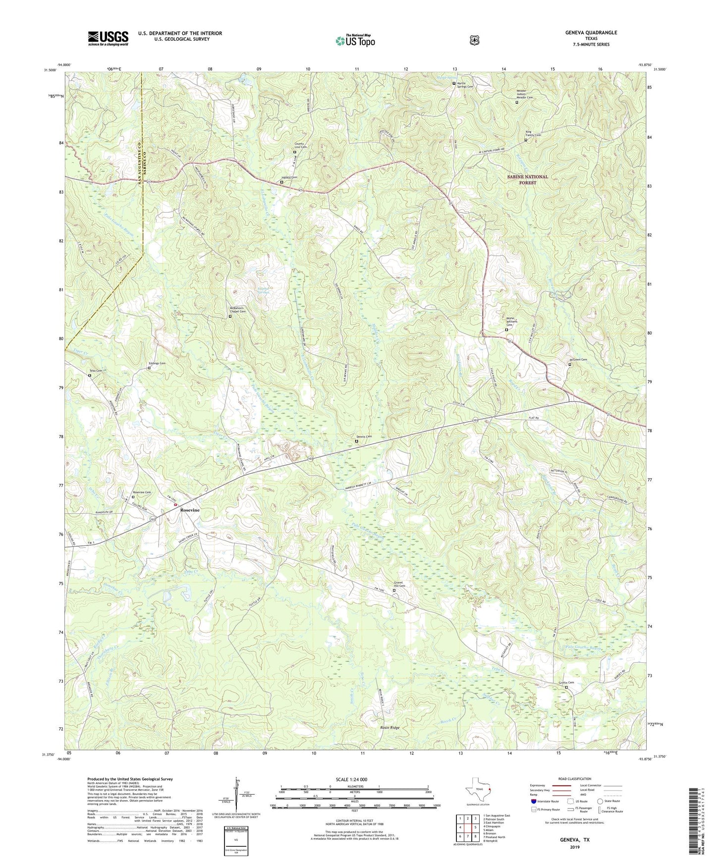
2019 topographic map quadrangle Geneva in the state of Texas. Scale: 1:24000. Based on the newly updated USGS 7.5' US Topo map series, this map is in the following counties: Sabine, San Augustine. The map contains contour data, water features, and other items you are used to seeing on USGS maps, but also has updated roads and other features. This is the next generation of topographic maps. Printed on high-quality waterproof paper with UV fade-resistant inks.
Quads adjacent to this one:
West: Chinquapin
Northwest: San Augustine East
North: Patroon South
Northeast: East Hamilton
East: Milam
Southeast: Hemphill
South: Pineland North
Southwest: Bronson
Contains the following named places: Apostolic Church, Beech Creek, Blackman Branch, Boyd Creek, County Line Cemetery, County Line Church, Dennis Cemetery, Donahue Creek, Eddings Cemetery, El Lobanillo Creek, Ellison Branch, Geneva, Gravel Hill Cemetery, Gravel Hill Church, Griffin Cemetery, Hankla Cemetery, King Family Cemetery, Maddox Creek, McGown Cemetery, McMahan Chapel, McMahon's Chapel Cemetery, Meador-Judson Meador Cemetery, Myrtle Spring, Myrtle Springs Cemetery, New Zion Church, Payne-Williams Cemetery, Rock Springs Church, Rocky Creek, Rosevine, Rosevine Cemetery, Rosevine Volunteer Fire Department, Rosin Ridge, Smith Creek, Sulphur Creek, Sulphur Springs, Tebo Cemetery, Thornburg Creek, Tiger Creek