MyTopo
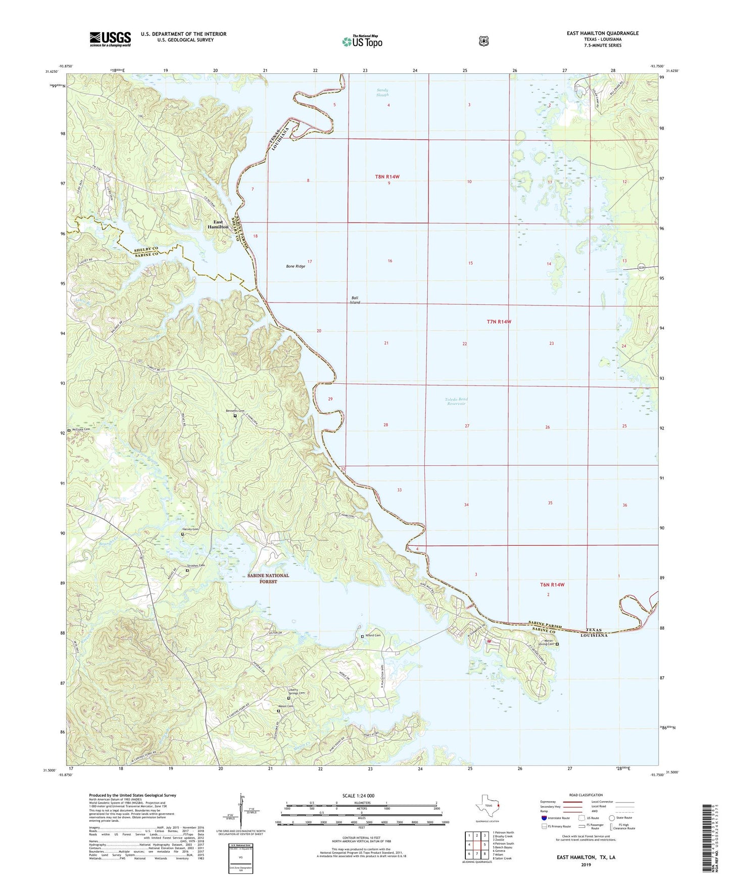
East Hamilton Texas US Topo Map
Couldn't load pickup availability
Also explore the East Hamilton Forest Service Topo of this same quad for updated USFS data
2022 topographic map quadrangle East Hamilton in the states of Texas, Louisiana. Scale: 1:24000. Based on the newly updated USGS 7.5' US Topo map series, this map is in the following counties: Sabine, Shelby. The map contains contour data, water features, and other items you are used to seeing on USGS maps, but also has updated roads and other features. This is the next generation of topographic maps. Printed on high-quality waterproof paper with UV fade-resistant inks.
Quads adjacent to this one:
West: Patroon South
Northwest: Patroon North
North: Brushy Creek
Northeast: Zwolle
East: Beech Bayou
Southeast: Salter Creek
South: Milam
Southwest: Geneva
This map covers the same area as the classic USGS quad with code o31093e7.
Contains the following named places: Alford Cemetery, Ball Island, Bayou San Patricio, Bennetts Cemetery, Black Lake, Blue Lake School, Bone Ridge, Bourghs Creek, Braggs Church, Brittain Creek, Brushy Lake, Buzzard Lake, Chamber Ferry, Cox Branch, Darnell Ferry, Donnell Lake, Dorsey Branch, East Hamilton, East Hamilton Boat Ramp Recreation Site, East Hamilton Church, Harvey Cemetery, Holmes River Lake, Horseshoe Lake, Isla, Lewis Branch, Liberty Springs Cemetery, Liberty Springs Church, Liberty Springs United Methodist Church, Martinez Bayou, Mason Cemetery, Mason Creek, McGuire Cemetery, Moran-Loving Cemetery, Mount Olive Church, Patroon Bayou Recreation Area, Reeves Creek, Round Pond, Saltworks Lake, Sandy Slough, Shamrock Shores Volunteer Fire Department, Strother Cemetery, Vines Old River Lake, Webb Lake, Wilson Creek, ZIP Code: 75959