MyTopo
Gholson Texas US Topo Map
Couldn't load pickup availability
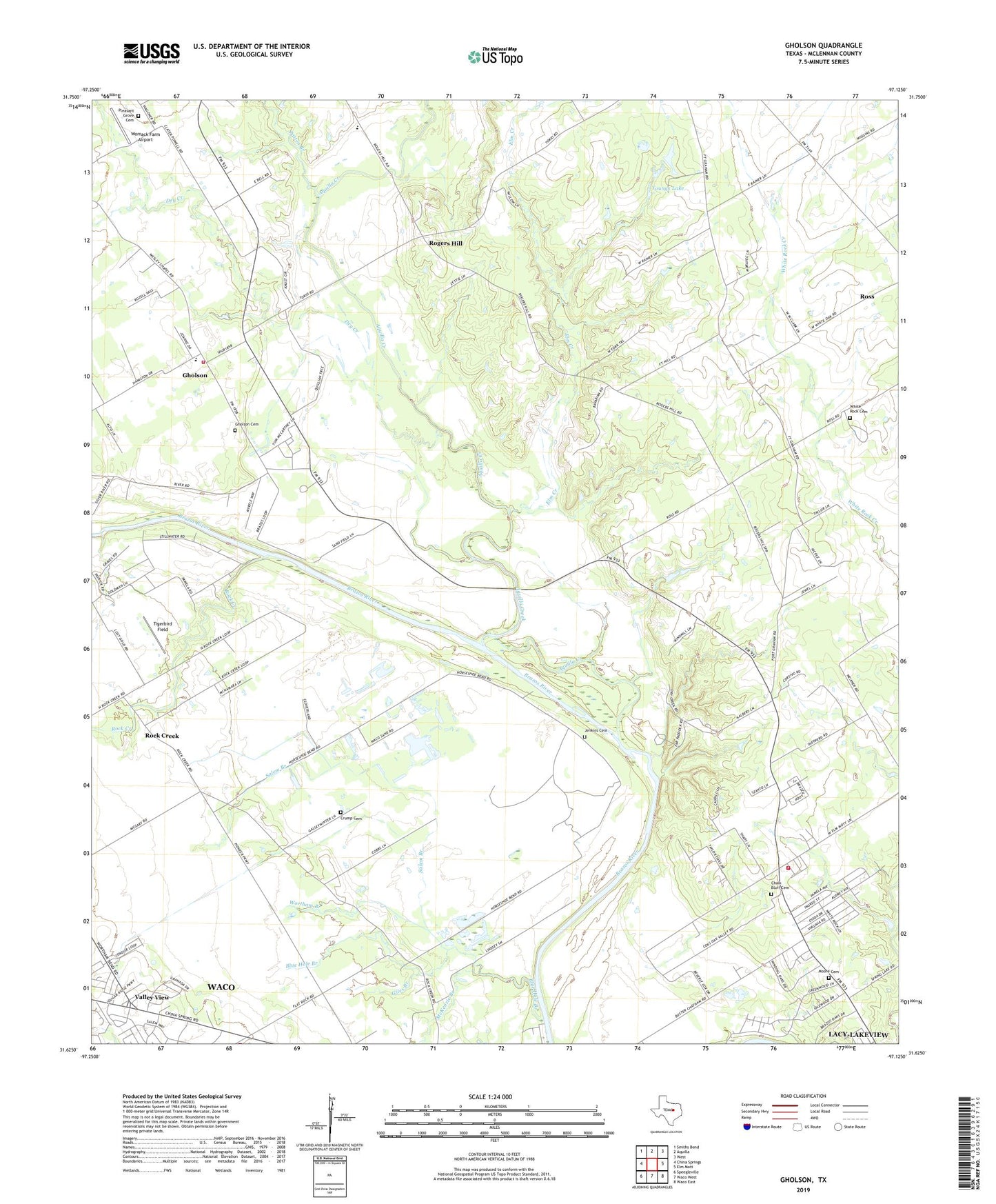
2019 topographic map quadrangle Gholson in the state of Texas. Scale: 1:24000. Based on the newly updated USGS 7.5' US Topo map series, this map is in the following counties: McLennan. The map contains contour data, water features, and other items you are used to seeing on USGS maps, but also has updated roads and other features. This is the next generation of topographic maps. Printed on high-quality waterproof paper with UV fade-resistant inks.
Quads adjacent to this one:
West: China Springs
Northwest: Smiths Bend
North: Aquilla
Northeast: West
East: Elm Mott
Southeast: Waco East
South: Waco West
Southwest: Speegleville
Contains the following named places: Aquilla Creek, Blue Hole Branch, Chalk Bluff Cemetery, Chalk Bluff Church, Chalk Bluff Volunteer Fire Department, Circle H Airport, City of Gholson, Crump Cemetery, Dry Creek, Elm Creek, Gholson, Gholson Cemetery, Gholson School, Gholson Volunteer Fire Department, Giles Branch, Hess Airport, Jenkins Cemetery, McKenzie Branch, Moore Cemetery, Patrick, Patten Branch, Pleasant Grove Cemetery, Rock Creek, Rogers Hill, Salem Branch, Tigerbird Field, Valley View, Wesley Chapel, White Rock Cemetery, Womack Farm Airport, Wortham Branch, Youngs Lake, Zion Hill Church, ZIP Code: 76708