MyTopo
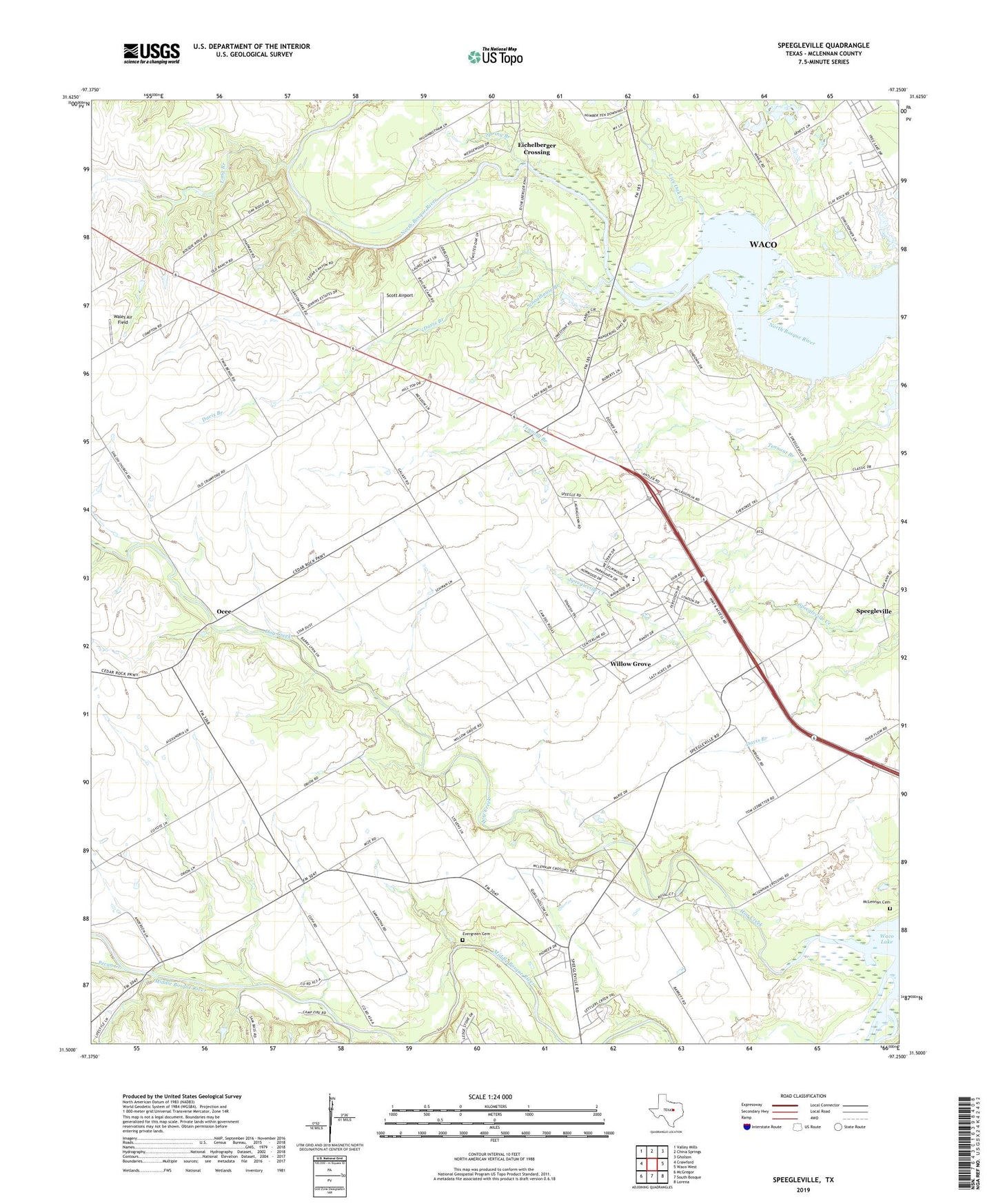
Speegleville Texas US Topo Map
Couldn't load pickup availability
2022 topographic map quadrangle Speegleville in the state of Texas. Scale: 1:24000. Based on the newly updated USGS 7.5' US Topo map series, this map is in the following counties: McLennan. The map contains contour data, water features, and other items you are used to seeing on USGS maps, but also has updated roads and other features. This is the next generation of topographic maps. Printed on high-quality waterproof paper with UV fade-resistant inks.
Quads adjacent to this one:
West: Crawford
Northwest: Valley Mills
North: China Springs
Northeast: Gholson
East: Waco West
Southeast: Lorena
South: South Bosque
Southwest: McGregor
This map covers the same area as the classic USGS quad with code o31097e3.
Contains the following named places: Boyd Field Airport, Caldwell Crossing, China Spring High School, Cougar Stadium, Davis Branch, Eichelberger Crossing, Evergreen Cemetery, Highland, Hog Creek, Live Oak Creek, Long Branch, McLennan Cemetery, Ocee, Pecan Creek, Schoolhouse Branch, Scott Airport, Shiloh Church, Speegleville, Speegleville United Methodist Church, Spring Branch, Val Verde Camp, Wales Air Field, Willow Grove, Willow Grove Census Designated Place, Willowgrove Baptist Church, Windsor, ZIP Code: 76712