MyTopo
China Springs Texas US Topo Map
Couldn't load pickup availability
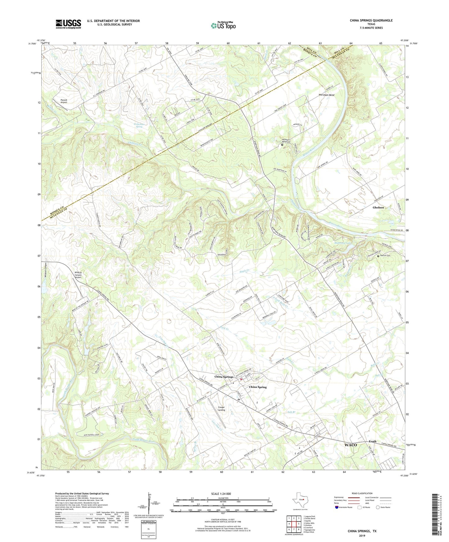
2022 topographic map quadrangle China Springs in the state of Texas. Scale: 1:24000. Based on the newly updated USGS 7.5' US Topo map series, this map is in the following counties: McLennan, Bosque, Hill. The map contains contour data, water features, and other items you are used to seeing on USGS maps, but also has updated roads and other features. This is the next generation of topographic maps. Printed on high-quality waterproof paper with UV fade-resistant inks.
Quads adjacent to this one:
West: Valley Mills
Northwest: Laguna Park
North: Smiths Bend
Northeast: Aquilla
East: Gholson
Southeast: Waco West
South: Speegleville
Southwest: Crawford
This map covers the same area as the classic USGS quad with code o31097f3.
Contains the following named places: Childress Creek, China Spring Alternative Education School, China Spring Census Designated Place, China Spring Division, China Spring Elementary School, China Spring Kindergarten, China Spring Middle School, China Spring Post Office, China Spring Volunteer Fire Department, China Springs, Community Baptist Church, Cougar Landing, Eagle Creek, El Flechazo Spring, Erath, Mahoney Lake, Mahoney Lake Dam, Mahoney South Lake, Mahoney South Lake Dam, McLennan County Constable's Office Precinct 4, North Fork Rock Creek, Oak Grove Church, Opportunity Learning Center - China Spring, Patrick Cemetery, Pocock Airport, Possum Creek, Salt Branch, Thompson Lake, Thompson Lake Dam, Wildcat Canyon, Wildcat Canyon Airport, Willow Creek, Wortham Bend, Wortham Bend Cemetery, ZIP Code: 76633