MyTopo
Smiths Bend Texas US Topo Map
Couldn't load pickup availability
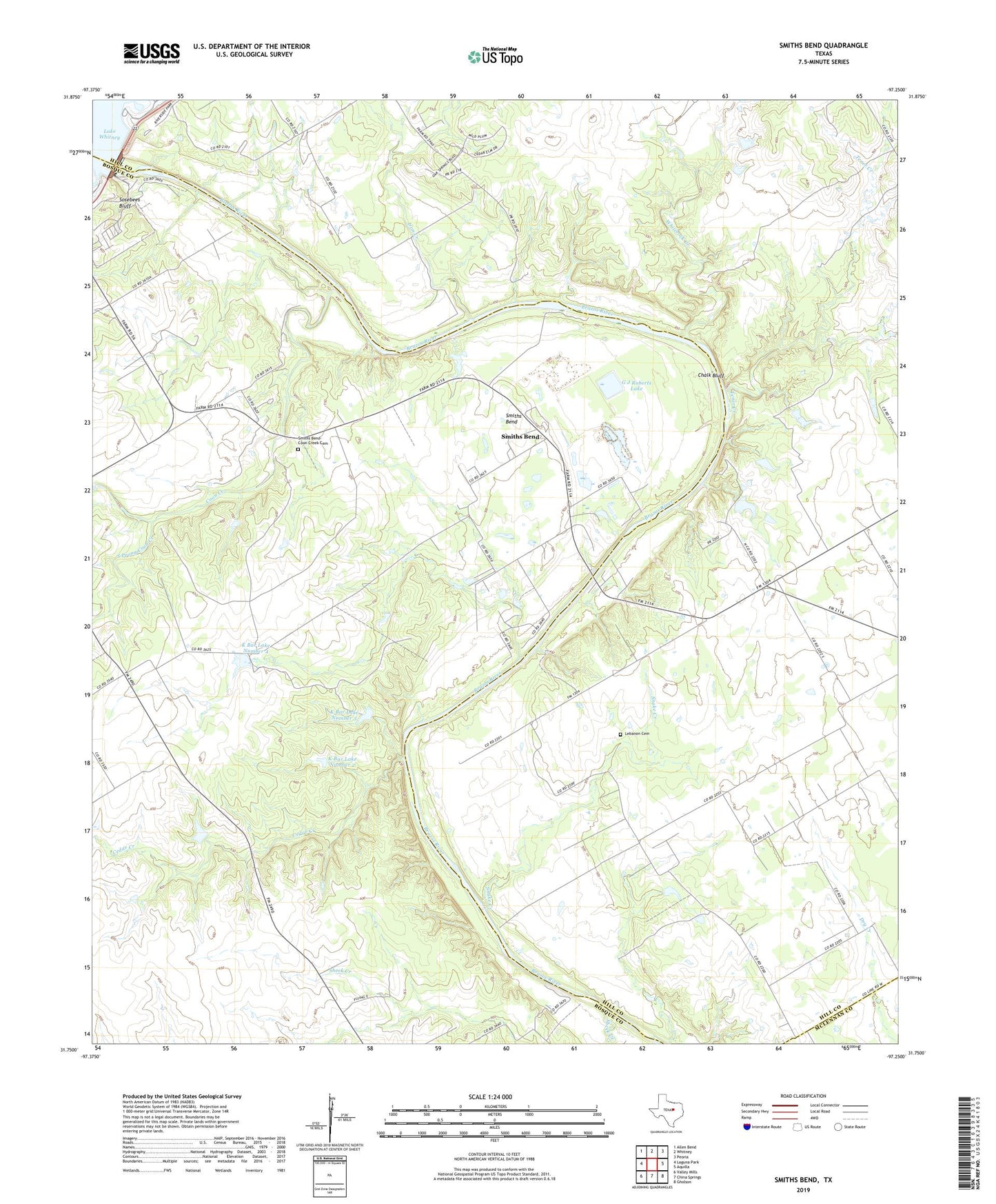
2022 topographic map quadrangle Smiths Bend in the state of Texas. Scale: 1:24000. Based on the newly updated USGS 7.5' US Topo map series, this map is in the following counties: Bosque, Hill, McLennan. The map contains contour data, water features, and other items you are used to seeing on USGS maps, but also has updated roads and other features. This is the next generation of topographic maps. Printed on high-quality waterproof paper with UV fade-resistant inks.
Quads adjacent to this one:
West: Laguna Park
Northwest: Allen Bend
North: Whitney
Northeast: Peoria
East: Aquilla
Southeast: Gholson
South: China Springs
Southwest: Valley Mills
This map covers the same area as the classic USGS quad with code o31097g3.
Contains the following named places: Burnett Lake, Burnett Lake Dam, Cedar Creek, Chalk Bluff, Coon Creek, G J Roberts Dam, G J Roberts Lake, Greenock, Iron Creek, K Bar Lake Number 1, K Bar Lake Number 1 Dam, K Bar Lake Number 2, K Bar Lake Number 2 Dam, K Bar Lake Number 3, K Bar Lake Number 3 Dam, K Bar Lake Number 4, K Bar Lake Number 4 Dam, Lake Whitney, Latham Springs Bible Camp, Lebanon, Lebanon Cemetery, Prairie Valley Bible Camp, Riverside Park, Sheek Creek, Smiths Bend, Smiths Bend-Coon Creek Cemetery, Snake Creek, Soldiers Bluff Park, Sosebees Bluff, South Prong Coon Creek, Spivey Crossing, Tener Creek, Whiterock Creek, Whitney Dam