MyTopo
Gober Texas US Topo Map
Couldn't load pickup availability
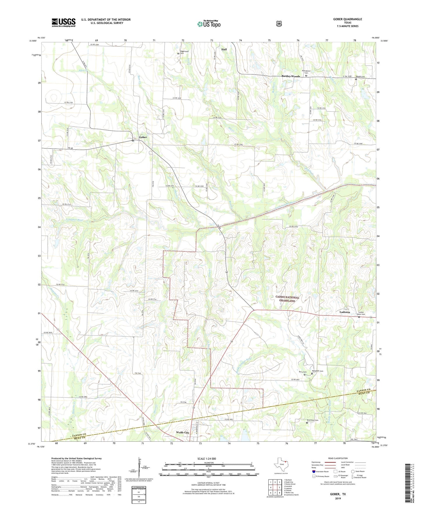
2019 topographic map quadrangle Gober in the state of Texas. Scale: 1:24000. Based on the newly updated USGS 7.5' US Topo map series, this map is in the following counties: Fannin, Hunt. The map contains contour data, water features, and other items you are used to seeing on USGS maps, but also has updated roads and other features. This is the next generation of topographic maps. Printed on high-quality waterproof paper with UV fade-resistant inks.
Quads adjacent to this one:
West: Leonard
Northwest: Bonham
North: Dodd City
Northeast: Honey Grove
East: Ladonia
Southeast: Commerce North
South: Wolfe City
Southwest: Celeste
Contains the following named places: Allen Creek, Bartley Woods, Bear Creek, Biggerstaff Cemetery, Brecheen Cemetery, Brushy Creek, Burrows and Harper Cemetery, Center Point Cemetery, Gober, Gober Cemetery, Gober Post Office, Henslee Family Cemetery, Long Creek, Minnow Ponds, Palestine Church, Philadelphia Cemetery, Philadelphia Church, Pot Creek, Providence Cemetery, Rehobeth Cemetery, Shawnee Creek, Spring Creek Cemetery, Spring Creek Church, Terry Cemetery, Woods Cemetery