MyTopo
Commerce North Texas US Topo Map
Couldn't load pickup availability
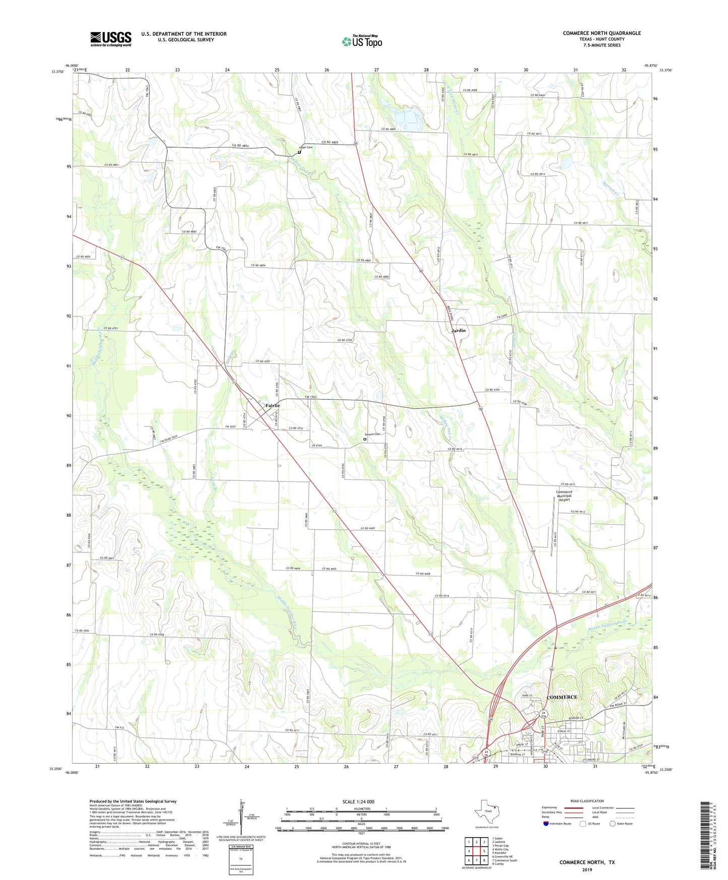
2022 topographic map quadrangle Commerce North in the state of Texas. Scale: 1:24000. Based on the newly updated USGS 7.5' US Topo map series, this map is in the following counties: Hunt. The map contains contour data, water features, and other items you are used to seeing on USGS maps, but also has updated roads and other features. This is the next generation of topographic maps. Printed on high-quality waterproof paper with UV fade-resistant inks.
Quads adjacent to this one:
West: Wolfe City
Northwest: Gober
North: Ladonia
Northeast: Pecan Gap
East: Klondike
Southeast: Cumby
South: Commerce South
Southwest: Greenville NE
This map covers the same area as the classic USGS quad with code o33095c8.
Contains the following named places: Bethel Church of God in Christ, Commerce Division, Commerce Municipal Airport, Durham, East Fork Pecan Creek, England Grove Church, Fairlie, Hope Cemetery, Hunt County Emergency Medical Services Station 3, Jardin, Long Branch, Lyndon Baines Johnson Park, Norris Park, Norris School, Presbyterian Church, Ridgecrest Baptist Church, Sonora Cemetery, Willow Oak Creek, ZIP Code: 75428