MyTopo
Bonham Texas US Topo Map
Couldn't load pickup availability
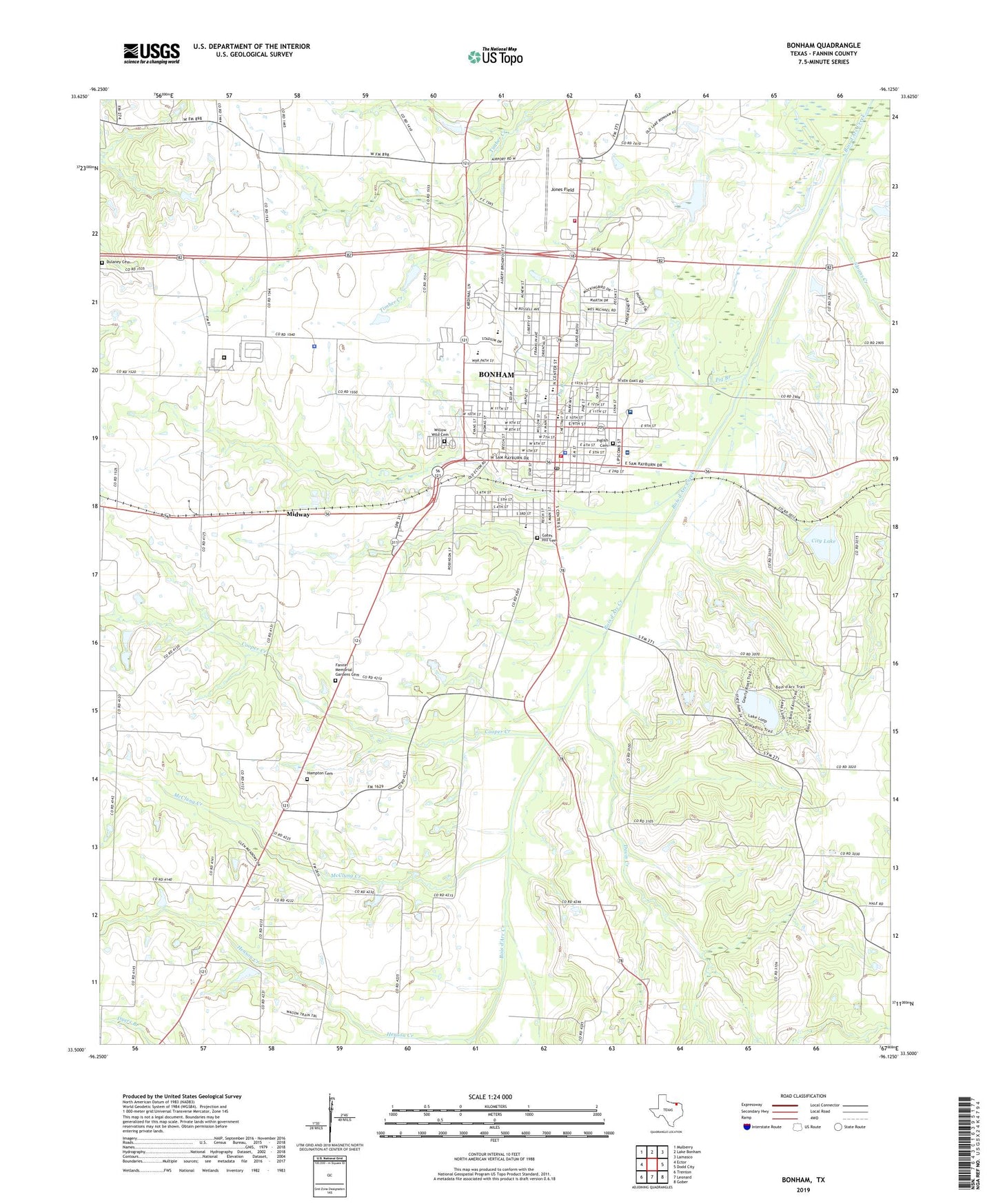
2022 topographic map quadrangle Bonham in the state of Texas. Scale: 1:24000. Based on the newly updated USGS 7.5' US Topo map series, this map is in the following counties: Fannin. The map contains contour data, water features, and other items you are used to seeing on USGS maps, but also has updated roads and other features. This is the next generation of topographic maps. Printed on high-quality waterproof paper with UV fade-resistant inks.
Quads adjacent to this one:
West: Ector
Northwest: Mulberry
North: Lake Bonham
Northeast: Lamasco
East: Dodd City
Southeast: Gober
South: Leonard
Southwest: Trenton
This map covers the same area as the classic USGS quad with code o33096e2.
Contains the following named places: Arledge Ridge, Arledge Ridge Cemetery, Bailey Inglish Cemetery, Bailey Inglish Elementary School, Bonham, Bonham City Hall, Bonham Division, Bonham Fire Department and Emergency Medical Service Station 1, Bonham Fire Department and Emergency Medical Service Station 2, Bonham High School, Bonham Police Department, Bonham Post Office, Bonham State Park, Bonham State Park Dam, Bonham State Park Lake, Bonham State Park Trail, Carpenter Family Cemetery, Central Baptist Church, City Dam, City Lake, City of Bonham, City of Bonham Softball Complex, Clendenen-Carleton House, Cooper Creek, DAEP Stephenson Campus, Davis Creek, Dulaney Cemetery, Edhube, English, Evans Elementary School, Fannin County Constable's Office Precinct 1, Fannin County Jail, Fannin County Law Enforcement Center South Annex Facility, Fannin County Museum of History, Fannin County Sheriff's Office, Fannin Memorial Gardens Cemetery, Finley - Oates Elementary School, First Penecostal Church of God, First Presbyterian Church, Freeman Creek, Gates Hill Cemetery, Hampton Cemetery, Henson Creek, Holy Trinity Episcopal Church, I W Evans Intermediate School, Jones Field, KFYN-AM (Bonham), KFYZ-FM (Bonham), L H Rather Junior High School, McClung Creek, Midway, Moore Chapel, Moore's Chapel Cemetery, New Home Baptist Church, New Life Pencostal Holiness Church, Newlife Church of God in Christ, Nunn House, Nunnelee, Pig Branch, Powder Creek, R V Ranch Airport, Rather Junior High School, Red River Regional Hospital, Rogers, Saint Elizabeth Catholic Church, Sam Rayburn House, Sam Rayburn Library, Sam Rayburn Memorial Veterans Center, Samuel T Rayburn House, Sloans Creek, Stephenson School, Texas and Pacific Railroad Depot, Texas Department of Criminal Justice Buster Cole State Jail, Texas Department of Criminal Justice Choice Moore Transfer Facility, Texas Department of Public Safety - Highway Patrol Office, Trinity Baptist Church, Warrior Stadium, Willow Wild Cemetery, Zion Lutheran Church, ZIP Code: 75418