MyTopo
Goodrich Texas US Topo Map
Couldn't load pickup availability
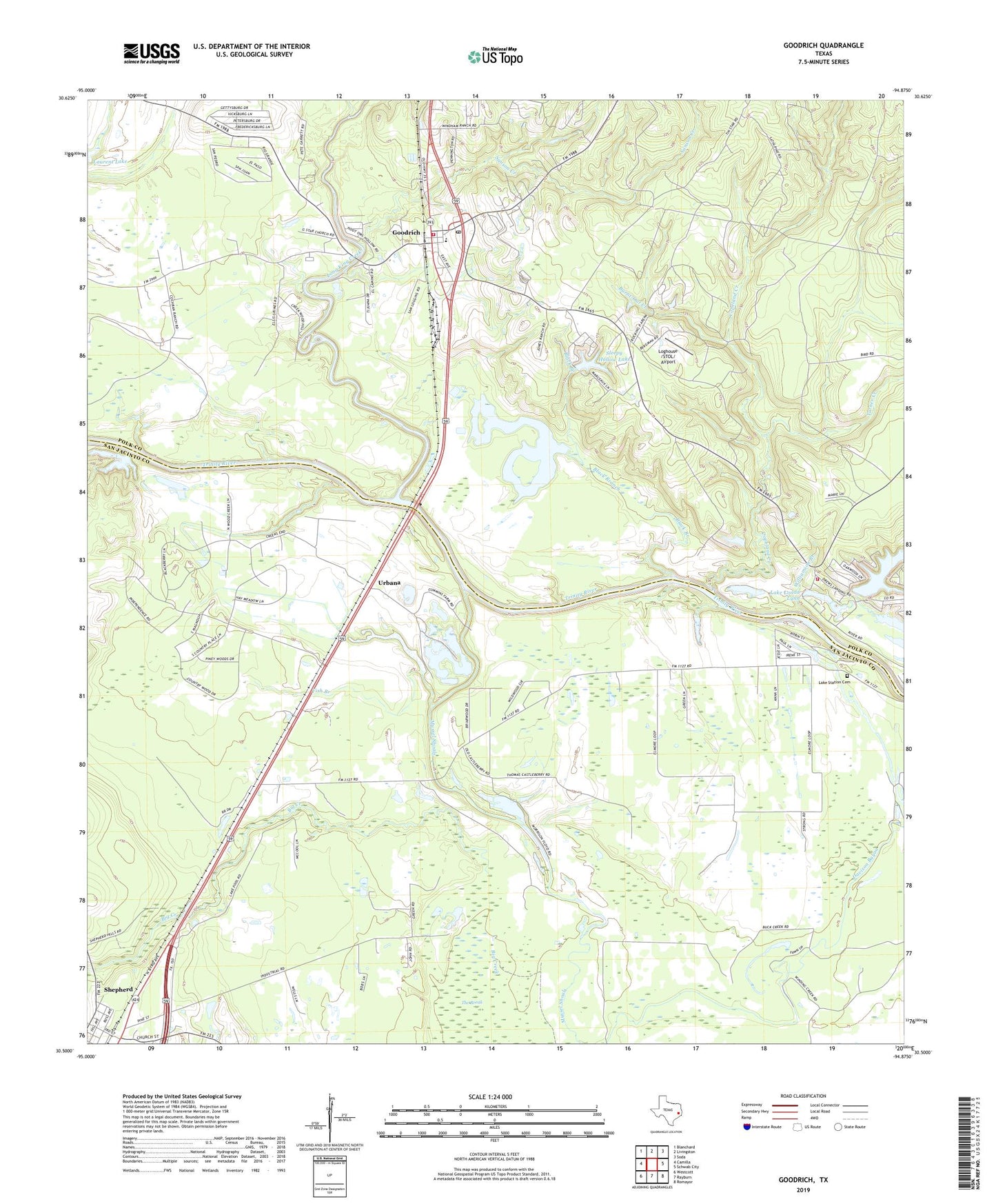
2019 topographic map quadrangle Goodrich in the state of Texas. Scale: 1:24000. Based on the newly updated USGS 7.5' US Topo map series, this map is in the following counties: San Jacinto, Polk. The map contains contour data, water features, and other items you are used to seeing on USGS maps, but also has updated roads and other features. This is the next generation of topographic maps. Printed on high-quality waterproof paper with UV fade-resistant inks.
Quads adjacent to this one:
West: Camilla
Northwest: Blanchard
North: Livingston
Northeast: Soda
East: Schwab City
Southeast: Romayor
South: Rayburn
Southwest: Westcott
Contains the following named places: Black Branch, Burnt-Out Creek, City of Goodrich, Copeland Creek, Fish Branch, Goodrich, Goodrich Post Office, Goodrich Volunteer Fire Department, Holiday Lake Estates Volunteer Fire Department, Lake Londa Lynn, Lake Londa Lynn Dam, Lake Pool Church, Lake Station Cemetery, Lake Station Church, Loghouse /STOL/ Airport, Long King Creek, McCardell Lake, Morgan Creek Oil Field, New Hope, Sanson Creek, Sleepy Hollow Lake, Sleepy Hollow Lake Dam, The Break, Turner Creek, Urbana, Williamson Branch, ZIP Code: 77335