MyTopo
Gorman Falls Texas US Topo Map
Couldn't load pickup availability
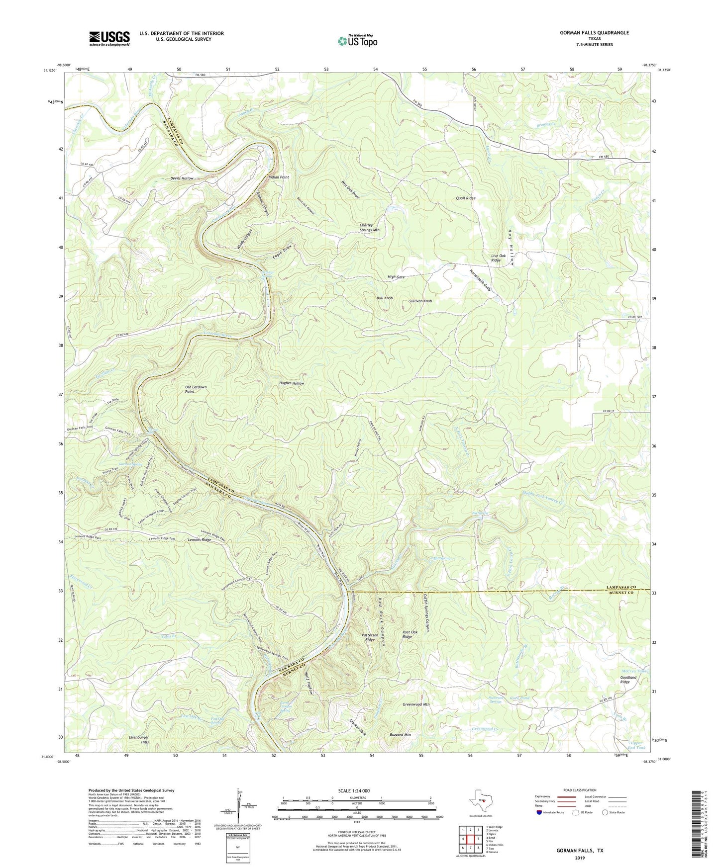
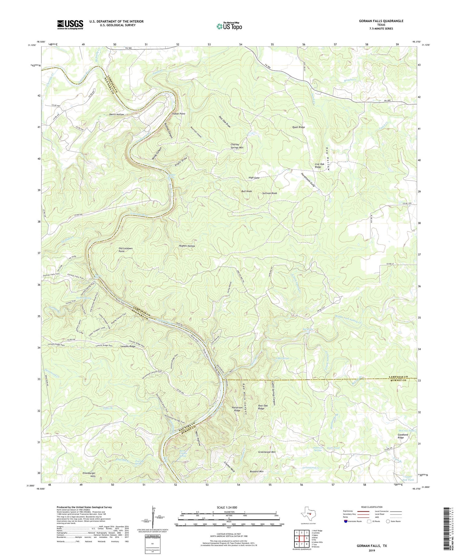
2019 topographic map quadrangle Gorman Falls in the state of Texas. Scale: 1:24000. Based on the newly updated USGS 7.5' US Topo map series, this map is in the following counties: Lampasas, San Saba, Burnet. The map contains contour data, water features, and other items you are used to seeing on USGS maps, but also has updated roads and other features. This is the next generation of topographic maps. Printed on high-quality waterproof paper with UV fade-resistant inks.
Quads adjacent to this one:
West: Bend
Northwest: Wolf Ridge
North: Lometa
Northeast: Ogles
East: Nix
Southeast: Naruna
South: Tow
Southwest: Indian Hills
Contains the following named places: Beartrack Canyon, Big Spring, Big Thicket, Brahma Canyon, Bull Knob, Burnt Canyon Spring, Buzzard Mountain, Cave Pond, Charley Springs Mountain, Cherokee Creek, Coffin Spring, Coffin Springs Canyon, Colorado Bend State Park, Colorado Bend State Park Trail, Cracker Neck, Devils Hollow, Eagle Draw, Goodland Ridge, Gorman Creek, Gorman Falls, Gorman Spring, Greenwood Mountain, High Gate, Hog Hollow, Horsetooth Gully, Hughes Hollow, Hurley Hollow, Indian Point, Jackson Ranch, Jennings Creek, Lemons Ridge, Lemons Springs Camp, Live Oak Ridge, Lynch Creek, McAnelly Creek, McCrea Branch, McCrea Tank, Middle Fork Yancey Creek, North Fork Yancey Creek, Old Letdown Point, Patterson Ridge, Patterson Springs, Post Oak Creek, Post Oak Draw, Post Oak Falls, Post Oak Ridge, Post Oak Spring, Quail Ridge, Rattlesnake Branch, Red Rock Canyon, Smith Ranch, South Fork Yancy Creek, Southwest Ledge Quarries, Spicewood Creek, Sullivan Knob, Sulphur Spring, Tie Slide Creek, Upper End Tank, Vann Branch, Vann Camp, Vann Ranch, Windy Canyon, Wolf Hollow, Yancey Creek, Yates Branch