MyTopo
Wolf Ridge Texas US Topo Map
Couldn't load pickup availability
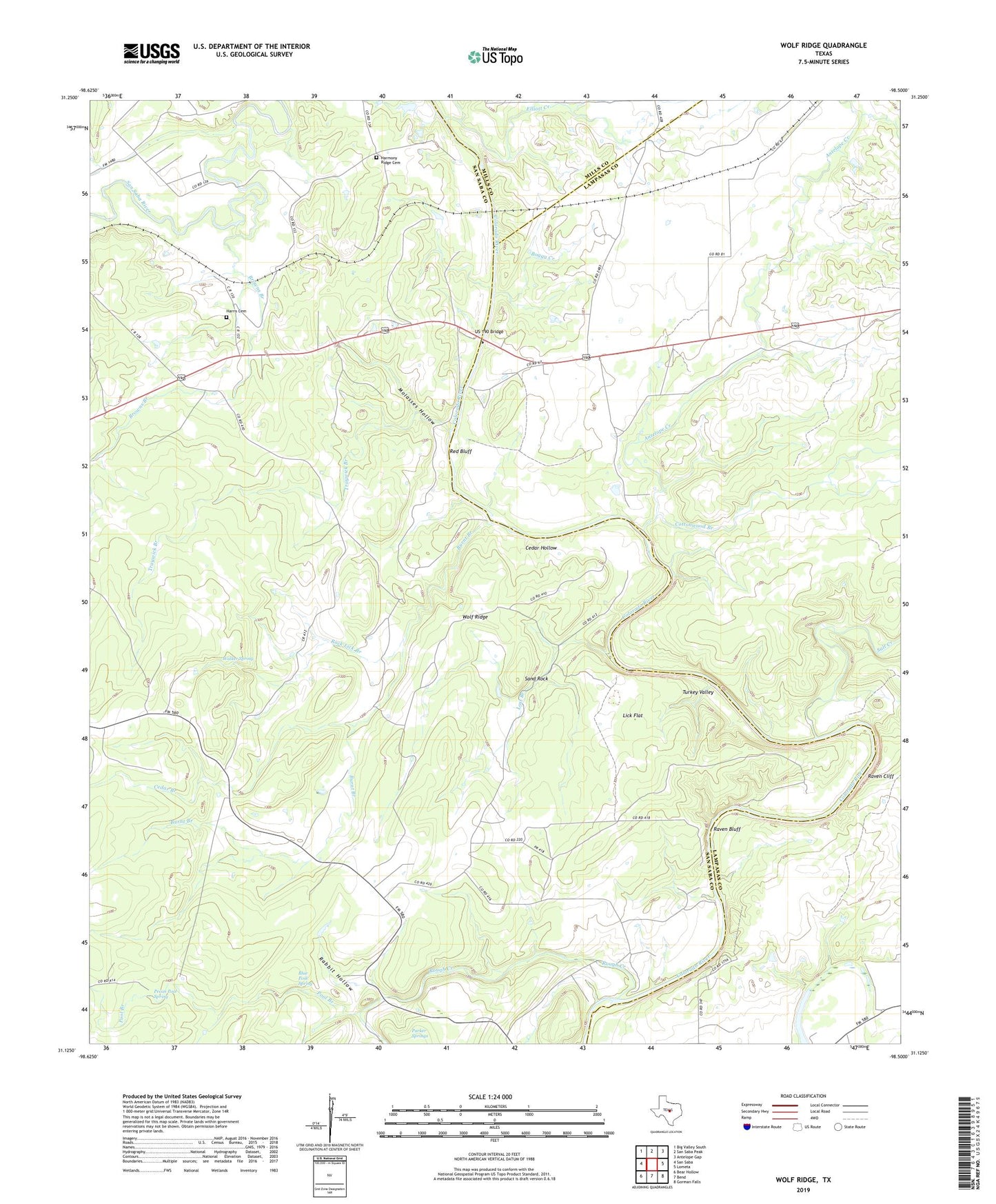
2022 topographic map quadrangle Wolf Ridge in the state of Texas. Scale: 1:24000. Based on the newly updated USGS 7.5' US Topo map series, this map is in the following counties: San Saba, Lampasas, Mills. The map contains contour data, water features, and other items you are used to seeing on USGS maps, but also has updated roads and other features. This is the next generation of topographic maps. Printed on high-quality waterproof paper with UV fade-resistant inks.
Quads adjacent to this one:
West: San Saba
Northwest: Big Valley South
North: San Saba Peak
Northeast: Antelope Gap
East: Lometa
Southeast: Gorman Falls
South: Bend
Southwest: Bear Hollow
This map covers the same area as the classic USGS quad with code o31098b5.
Contains the following named places: Antelope Creek, Blue Pool Spring, Boggy Creek, Browns Branch, Burnt Branch, Cedar Branch, Cedar Hollow, Colony Church, Cottonwood Branch, Elliott Creek, Glory Hole, Harmony Ridge Cemetery, Harris Cemetery, Hicks Crossing, Historical Monument, Lick Flat, Lost Branch, Molasses Hollow, Parker Springs, Parks Mill, Pecan Pool Spring, Pool Branch, Rabbit Hollow, Raven Bluff, Raven Cliff, Red Bluff, Red Bluff Crossing, Robinson Ranch, Rock Lick Branch, Rough Creek, Rough Creek Crossing, Salt Creek, Sand Rock, Star Camp, Traywick Branch, Turkey Valley, US 190 Bridge, Walker Spring, Wolf Ridge