MyTopo
Grand Saline Texas US Topo Map
Couldn't load pickup availability
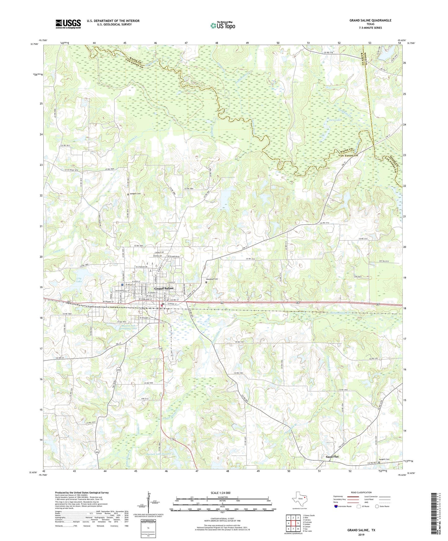
2019 topographic map quadrangle Grand Saline in the state of Texas. Scale: 1:24000. Based on the newly updated USGS 7.5' US Topo map series, this map is in the following counties: Van Zandt, Rains, Wood. The map contains contour data, water features, and other items you are used to seeing on USGS maps, but also has updated roads and other features. This is the next generation of topographic maps. Printed on high-quality waterproof paper with UV fade-resistant inks.
Quads adjacent to this one:
West: Fruitvale
Northwest: Emory South
North: Alba
Northeast: Calvary
East: Golden
Southeast: Van Lake
South: Van
Southwest: Canton
Contains the following named places: Big Lake, Big Lake Dam, Caney Creek, Central Church, Chrestman Branch, City Lake, City of Grand Saline, City of Grand Saline Dam, Collins Ferry, Cornerstone United Pentecostal Church, Crossroads Church, Darnell Dam Number 3, Darnell Dam Number 4, Darnell Lake Number 3, Darnell Lake Number 4, Davis Branch, Dodds Creek, First Pentecostal Church, Franks Creek, Friendship School, Grand Saline, Grand Saline City Hall, Grand Saline Division, Grand Saline Elementary School, Grand Saline Fire Department / Emergency Medical Service, Grand Saline High School, Grand Saline Intermediate School, Grand Saline Police Department, Grand Saline Post Office, Grnad Saline Middle School, Jones Lake, Jones Lake Dam, Koonce Creek, Lake Louise, Lake Louise Dam, Leatherman Creek, Little Saline Creek, Main Street Baptist Church, Maud Smith Marks Branch Library, Morton Mine, Morton Salt Company Dam, Morton Salt Company Lake, Number Five Branch, Padgett Cemetery, Rodgers Cemetery, Sand Flat, Simpkins Creek, Twin Lakes, Van Zandt County Constable's Office Precinct 1, Van Zandt Regional Medical Center, Woodside Cemetery, ZIP Code: 75140