MyTopo
Van Lake Texas US Topo Map
Couldn't load pickup availability
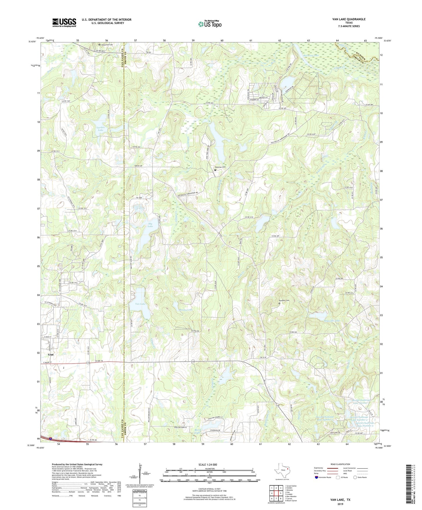
2022 topographic map quadrangle Van Lake in the state of Texas. Scale: 1:24000. Based on the newly updated USGS 7.5' US Topo map series, this map is in the following counties: Smith, Van Zandt, Wood. The map contains contour data, water features, and other items you are used to seeing on USGS maps, but also has updated roads and other features. This is the next generation of topographic maps. Printed on high-quality waterproof paper with UV fade-resistant inks.
Quads adjacent to this one:
West: Van
Northwest: Grand Saline
North: Golden
Northeast: Mineola
East: Lindale
Southeast: Mount Sylvan
South: Carroll
Southwest: Ben Wheeler
This map covers the same area as the classic USGS quad with code o32095e5.
Contains the following named places: Bearfield Branch, Bowman Cemetery, Brushy Branch, Bunkley Cemetery, Burleson Lake, Campbell Dam, Campbell Lake, Coppers Branch, Dickerson Cemetery, Duck Creek Church, Fairbanks Branch Library, Garden Lake, Garden Lake Dam, Garden Valley, Holiday Pines Dam, Holiday Pines Lake, Jamestown, Marsh Lake, Marsh Lake Dam, Miller Lake, Miller Lake Dam, Mosley Lake, Mosley Lake Dam, Niblack Branch, Providence Church, Reeves Lake, Reeves Lake Dam, Reynolds Lake, Reynolds Lake Dam, Rock Creek Church, Saint Mary Baptist Church, Sandy Creek Dam, Sky Lake, Union Chapel, Valley Club Lake, Valley Club Lake Dam, Van Lake, Van Lake Dam, Village Creek, Wisdom Temple, World Challenge Lake Number 1, World Challenge Lake Number 1 Dam, World Challenge Lake Number 2, World Challenge Lake Number 2 Dam, World Challenge Lake Number 3, World Challenge Lake Number 3 Dam, World Challenge Lake Number 4, World Challenge Lake Number 4 Dam, World Challenge Lake Number 5, World Challenge Lake Number 5 Dam