MyTopo
Gunter Texas US Topo Map
Couldn't load pickup availability
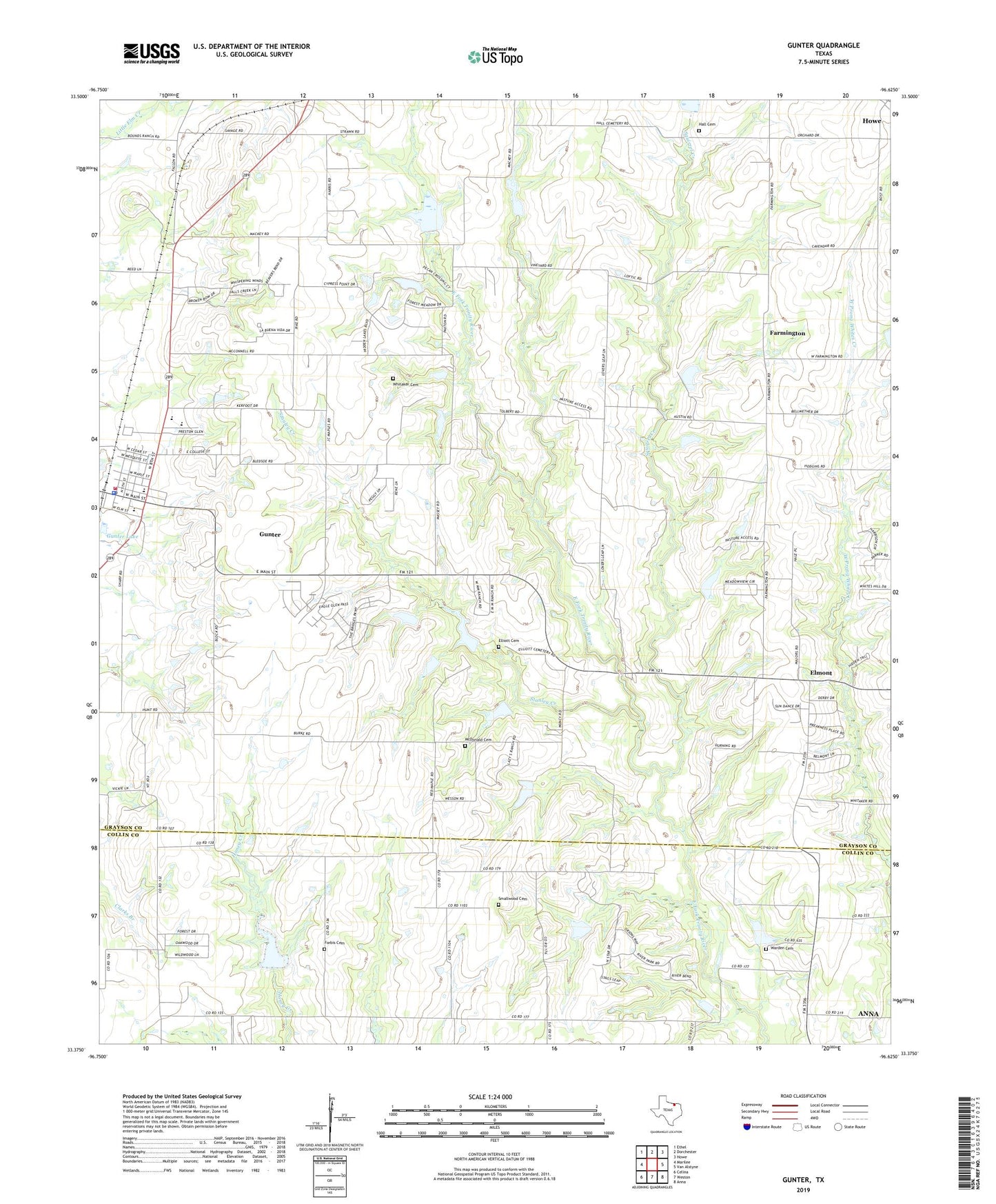
2019 topographic map quadrangle Gunter in the state of Texas. Scale: 1:24000. Based on the newly updated USGS 7.5' US Topo map series, this map is in the following counties: Grayson, Collin. The map contains contour data, water features, and other items you are used to seeing on USGS maps, but also has updated roads and other features. This is the next generation of topographic maps. Printed on high-quality waterproof paper with UV fade-resistant inks.
Quads adjacent to this one:
West: Marilee
Northwest: Ethel
North: Dorchester
Northeast: Howe
East: Van Alstyne
Southeast: Anna
South: Weston
Southwest: Celina
Contains the following named places: Bear Creek, Bishop's Landing, City of Gunter, College Hill Church of Christ, Elliott Cemetery, Elm View, Elmont, Farmington, Forbis Cemetery, Gunter, Gunter City Hall, Gunter Elementary School, Gunter Lake, Gunter Police Department, Gunter Post Office, Gunter Volunteer Fire and Rescue, Hall Cemetery, McDonald Cemetery, Simpson Family Cemetery, Smallwood Cemetery, Soil Conservation Service Site 19 Dam, Soil Conservation Service Site 19 Reservoir, Soil Conservation Service Site 20 Dam, Soil Conservation Service Site 20 Reservoir, Soil Conservation Service Site 20a Dam, Soil Conservation Service Site 20-A Reservoir, Soil Conservation Service Site 21 Dam, Soil Conservation Service Site 21 Reservoir, Soil Conservation Service Site 22 Dam, Soil Conservation Service Site 22 Reservoir, Soil Conservation Service Site 26 Dam, Soil Conservation Service Site 26 Reservoir, Soil Conservation Service Site 26a Dam, Soil Conservation Service Site 26a Reservoir, Soil Conservation Service Site 26b Dam, Soil Conservation Service Site 26b Reservoir, Soil Conservation Service Site 27 Dam, Soil Conservation Service Site 27 Reservoir, Soil Conservation Service Site 28 Dam, Soil Conservation Service Site 28 Reservoir, Soil Conservation Service Site 29 Dam, Soil Conservation Service Site 29 Reservoir, Soil Conservation Service Site 29a Dam, Soil Conservation Service Site 29a Reservoir, Soil Conservation Service Site 30 Dam, Soil Conservation Service Site 30 Reservoir, Soil Conservation Service Site 35 Dam, Soil Conservation Service Site 35 Reservoir, Soil Conservation Service Site 35a Dam, Soil Conservation Service Site 35a Reservoir, Soil Conservation Service Site 36 Dam, Soil Conservation Service Site 37 Dam, Soil Conservation Service Site 37 Reservoir, Soil Conservation Service Site 38 Dam, Soil Conservation Service Site 38 Reservoir, Soil Conservation Service Site 8g Dam, Soil Conservation Service Site 8g Reservoir, Soil Conservation Service Site Number 36 Reservoir, Squirrel Creek, Stanley Creek, Warden Cemetery, Whitaker Cemetery, ZIP Code: 75058