MyTopo
Gustine Texas US Topo Map
Couldn't load pickup availability
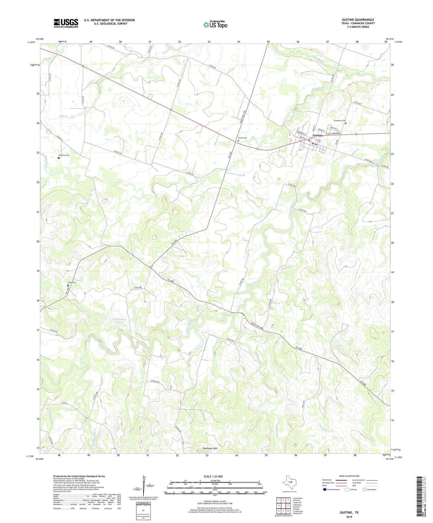
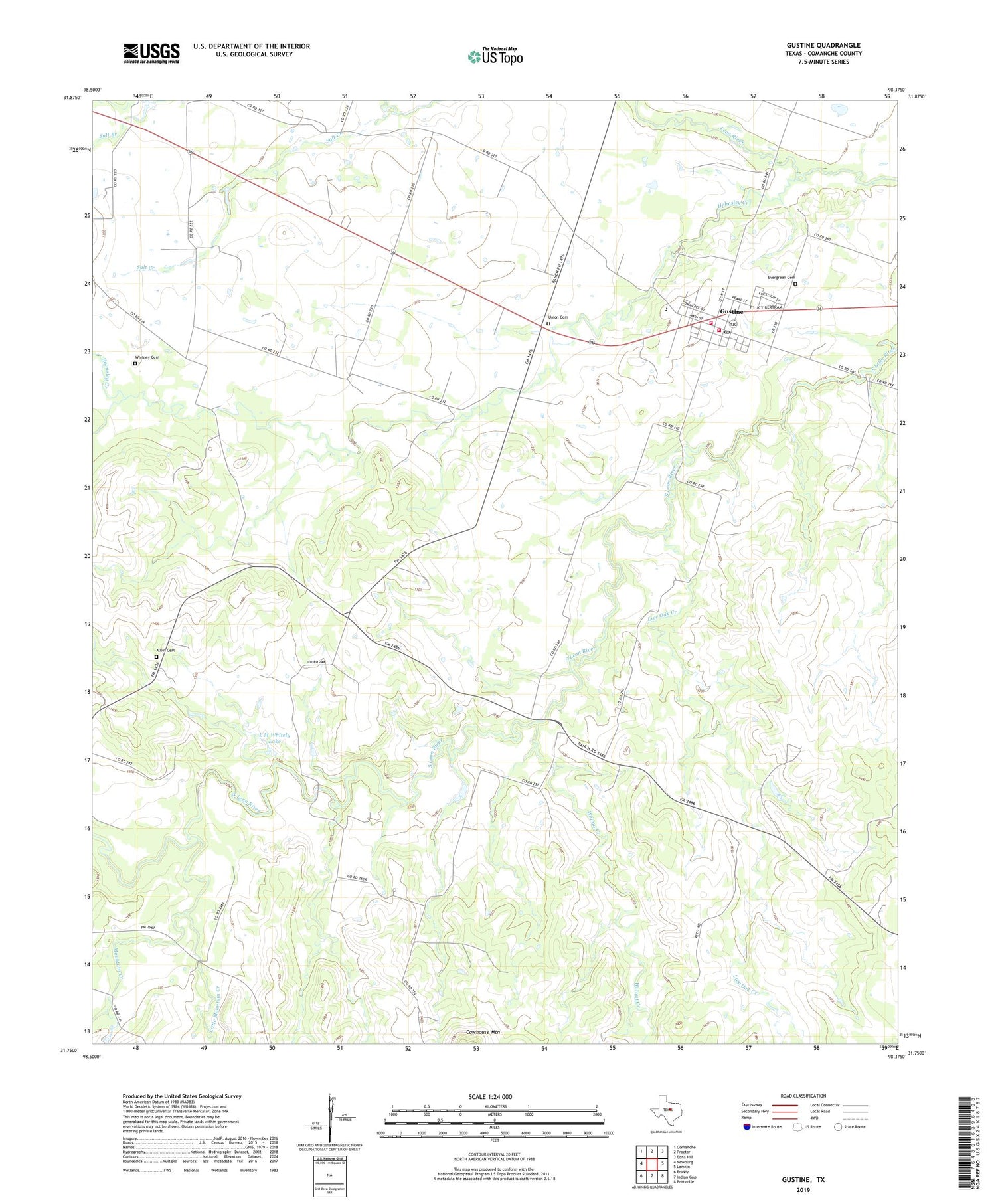
2019 topographic map quadrangle Gustine in the state of Texas. Scale: 1:24000. Based on the newly updated USGS 7.5' US Topo map series, this map is in the following counties: Comanche. The map contains contour data, water features, and other items you are used to seeing on USGS maps, but also has updated roads and other features. This is the next generation of topographic maps. Printed on high-quality waterproof paper with UV fade-resistant inks.
Quads adjacent to this one:
West: Newburg
Northwest: Comanche
North: Proctor
Northeast: Edna Hill
East: Lamkin
Southeast: Pottsville
South: Indian Gap
Southwest: Priddy
Contains the following named places: Albin Cemetery, Evergreen Cemetery, Fleming, Gustine, Gustine Post Office, Gustine Stadium, Gustine Volunteer Fire Department, Gustine Volunteer Volunteer Fire Department, Holmsley Creek, L M Whitely Dam, L M Whitely Lake, Little Mountain Creek, Live Oak Creek, Mountain Creek, Petitt School, Salt Creek, Town of Gustine, Union Cemetery, Walnut Creek, Whitney Cemetery, Yoakum Airport, ZIP Code: 76455