MyTopo
Proctor Texas US Topo Map
Couldn't load pickup availability
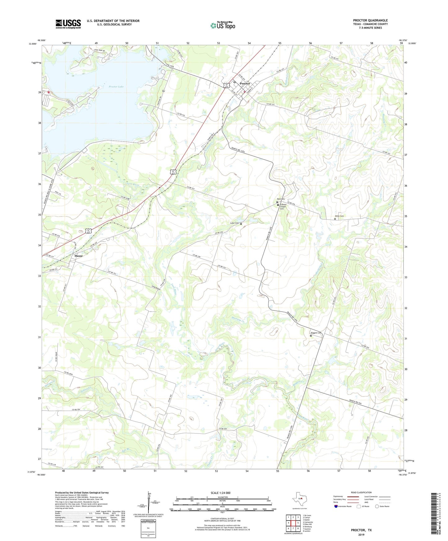
2022 topographic map quadrangle Proctor in the state of Texas. Scale: 1:24000. Based on the newly updated USGS 7.5' US Topo map series, this map is in the following counties: Comanche. The map contains contour data, water features, and other items you are used to seeing on USGS maps, but also has updated roads and other features. This is the next generation of topographic maps. Printed on high-quality waterproof paper with UV fade-resistant inks.
Quads adjacent to this one:
West: Comanche
Northwest: De Leon
North: Comyn
Northeast: Dublin
East: Edna Hill
Southeast: Lamkin
South: Gustine
Southwest: Newburg
This map covers the same area as the classic USGS quad with code o31098h4.
Contains the following named places: Baggett Cemetery, Baggett Creek, Baggett Creek Church, Board Church, Board Church Cemetery, Dargan Creek, Graham Chapel Cemetery, Hasse, Hasse School, Indian Creek, Long Hollow, Luker Cemetery, Miller Cemetery, Mustang Creek, Proctor, Proctor Census Designated Place, Proctor Lake, Proctor Post Office, Proctor Volunteer Fire Department, Promontory Park Volunteer Fire Department, Reid Cemetery, Rush Creek, Salt Branch, Sowell Creek Park, Sowells Creek, Walnut Creek