MyTopo
Newburg Texas US Topo Map
Couldn't load pickup availability
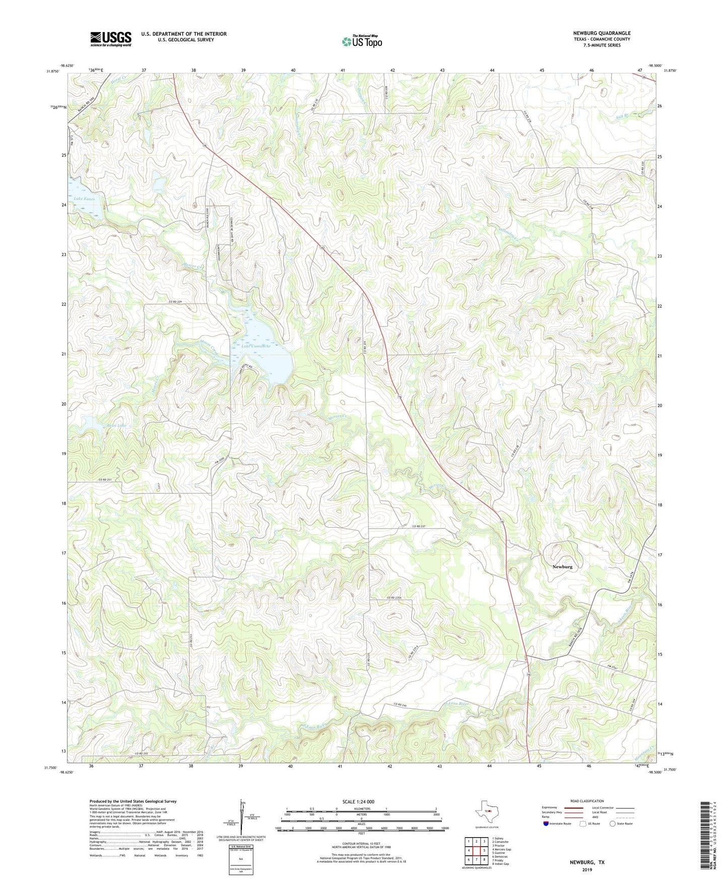
2022 topographic map quadrangle Newburg in the state of Texas. Scale: 1:24000. Based on the newly updated USGS 7.5' US Topo map series, this map is in the following counties: Comanche. The map contains contour data, water features, and other items you are used to seeing on USGS maps, but also has updated roads and other features. This is the next generation of topographic maps. Printed on high-quality waterproof paper with UV fade-resistant inks.
Quads adjacent to this one:
West: Mercers Gap
Northwest: Sidney
North: Comanche
Northeast: Proctor
East: Gustine
Southeast: Indian Gap
South: Priddy
Southwest: Democrat
This map covers the same area as the classic USGS quad with code o31098g5.
Contains the following named places: Bean Dam, Bean Lake, Cedar Branch, Lake Comanche, Lake Comanche Dam, Lake Eanes, Lake Eanes Dam, Lake Eanes Park, Mercer Creek, Moore Creek, Newburg, Shiloh Cemetery, Shiloh Church