MyTopo
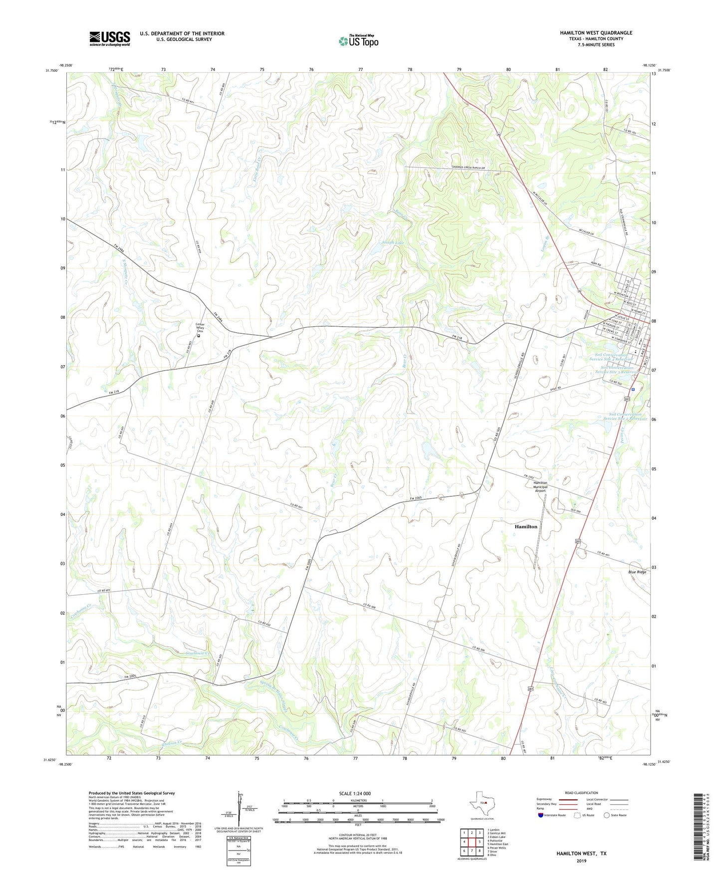
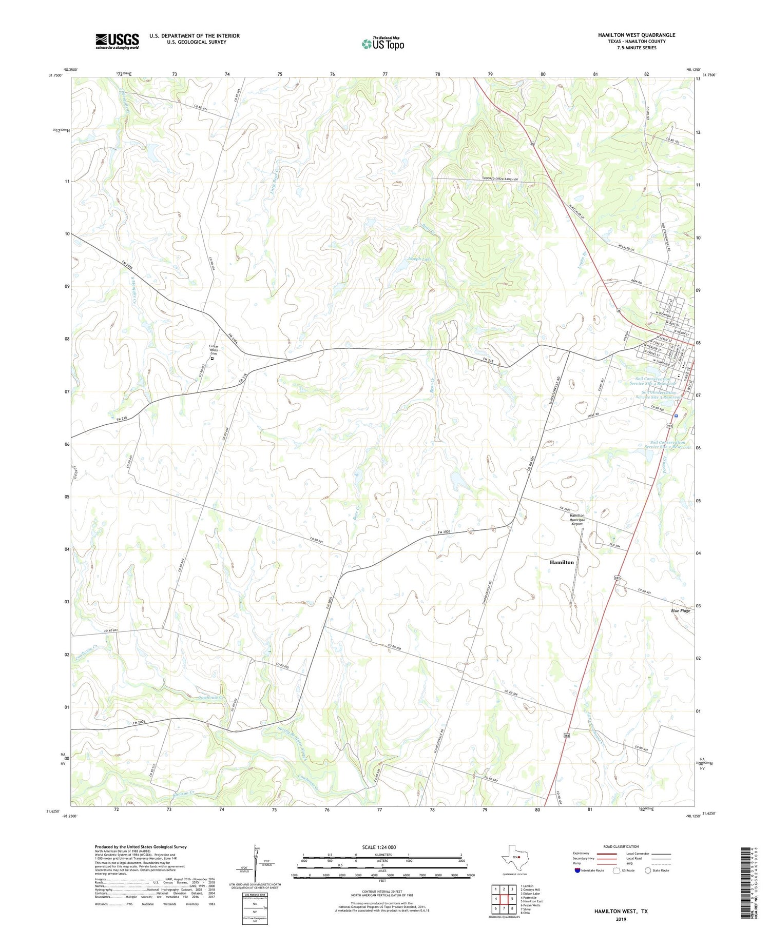
Hamilton West Texas US Topo Map
Couldn't load pickup availability
2019 topographic map quadrangle Hamilton West in the state of Texas. Scale: 1:24000. Based on the newly updated USGS 7.5' US Topo map series, this map is in the following counties: Hamilton. The map contains contour data, water features, and other items you are used to seeing on USGS maps, but also has updated roads and other features. This is the next generation of topographic maps. Printed on high-quality waterproof paper with UV fade-resistant inks.
Quads adjacent to this one:
West: Pottsville
Northwest: Lamkin
North: Gentrys Mill
Northeast: Eidson Lake
East: Hamilton East
Southeast: Ohio
South: Shive
Southwest: Pecan Wells
Contains the following named places: Center Valley Cemetery, Gholson Creek, Hamilton City Park, Hamilton County Jail, Hamilton County Sheriff's Office, Hamilton Division, Hamilton Elementary and Junior High School, Hamilton High School, Hamilton Municipal Airport, Joseph Lake, Joseph Lake Dam, KCLW-FM (Hamilton), KoeS-AM (Hamilton), Lund Valley Church, Midway, Perry Country Club Golf Course, Soil Conservation Service Site 2 Dam, Soil Conservation Service Site 2 Reservoir, Soil Conservation Service Site 3 Dam, Soil Conservation Service Site 3 Reservoir, Soil Conservation Service Site 4 Dam, Soil Conservation Service Site 4 Reservoir, Soil Conservation Service Site 5 Dam, Soil Conservation Service Site 5 Reservoir, Spring Branch Hiller Slough, ZIP Code: 76531