MyTopo
Pecan Wells Texas US Topo Map
Couldn't load pickup availability
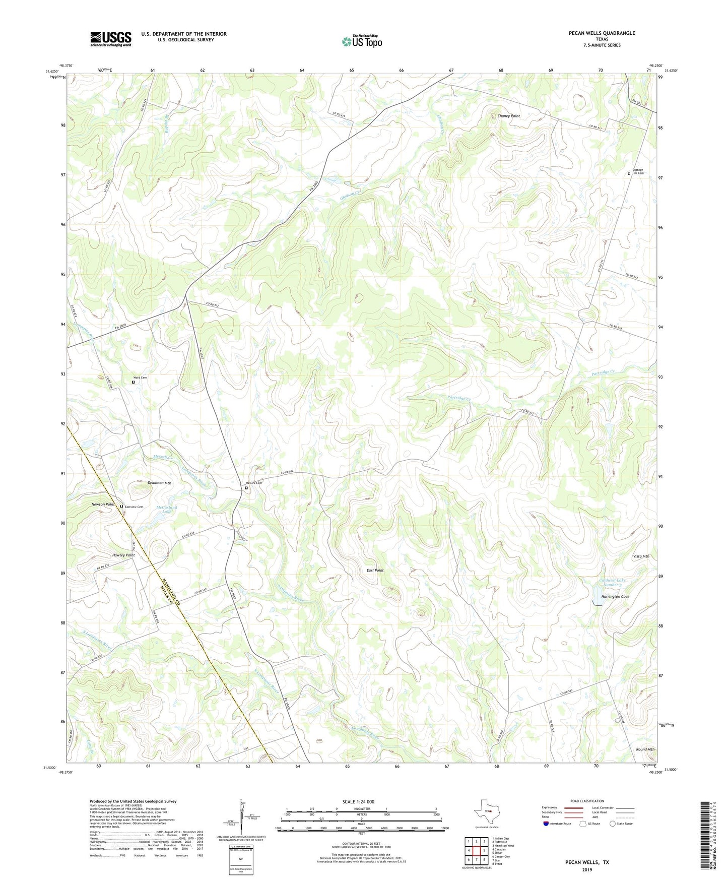
2022 topographic map quadrangle Pecan Wells in the state of Texas. Scale: 1:24000. Based on the newly updated USGS 7.5' US Topo map series, this map is in the following counties: Hamilton, Mills. The map contains contour data, water features, and other items you are used to seeing on USGS maps, but also has updated roads and other features. This is the next generation of topographic maps. Printed on high-quality waterproof paper with UV fade-resistant inks.
Quads adjacent to this one:
West: Caradan
Northwest: Indian Gap
North: Pottsville
Northeast: Hamilton West
East: Shive
Southeast: Evant
South: Star
Southwest: Center City
This map covers the same area as the classic USGS quad with code o31098e3.
Contains the following named places: Caldwell Lake Number 3, Caldwell Lake Number 3 Dam, Chaney Point, Cottage Hill Cemetery, Deadman Mountain, Earl Point, Eastview Cemetery, Harrington Cove, Hawley Point, Hill Ranch, Hunt Lake, Hunt Lake Dam, McCasland Lake, McCasland Lake Dam, McGirk, McGirk Cemetery, McGirk School, Merrell Creek, Newton Point, Pecan Wells, Round Mountain, South Lampasas River, Springdale, Ward Cemetery