MyTopo
Hamon Texas US Topo Map
Couldn't load pickup availability
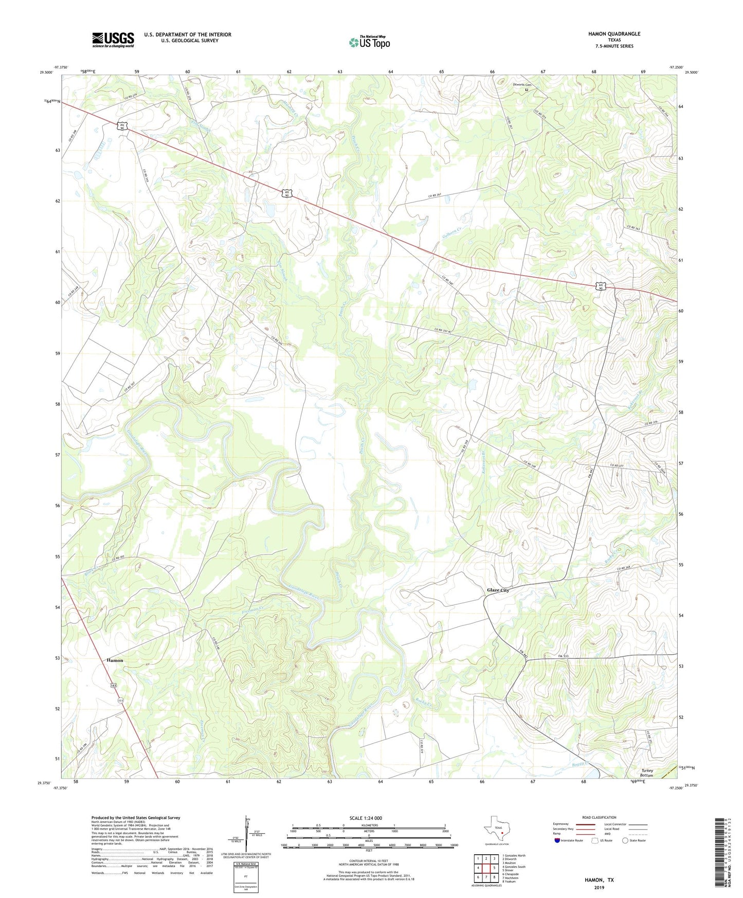
2019 topographic map quadrangle Hamon in the state of Texas. Scale: 1:24000. Based on the newly updated USGS 7.5' US Topo map series, this map is in the following counties: Gonzales, DeWitt. The map contains contour data, water features, and other items you are used to seeing on USGS maps, but also has updated roads and other features. This is the next generation of topographic maps. Printed on high-quality waterproof paper with UV fade-resistant inks.
Quads adjacent to this one:
West: Gonzales South
Northwest: Gonzales North
North: Dilworth
Northeast: Moulton
East: Shiner
Southeast: Yoakum
South: Hochheim
Southwest: Cheapside
Contains the following named places: Abercrombie Ranch, Black Creek, Braches House, Dilworth Cemetery, Dilworth Church, Elm Slough, Freeman Creek, Gelhorn Creek, Glaze City, Hamon, Hamon Church, Kokernot, Kokernot Branch, Mitchell Creek, Peach Creek, Rocky Creek