MyTopo
Dilworth Texas US Topo Map
Couldn't load pickup availability
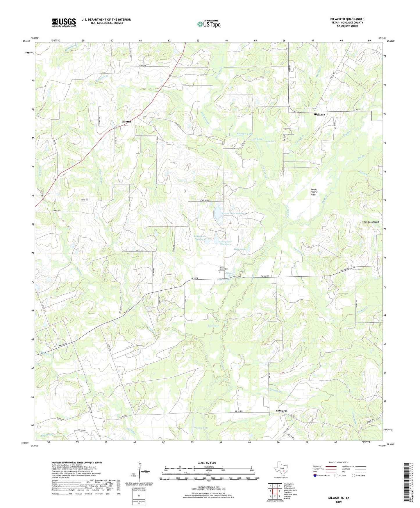
2022 topographic map quadrangle Dilworth in the state of Texas. Scale: 1:24000. Based on the newly updated USGS 7.5' US Topo map series, this map is in the following counties: Gonzales. The map contains contour data, water features, and other items you are used to seeing on USGS maps, but also has updated roads and other features. This is the next generation of topographic maps. Printed on high-quality waterproof paper with UV fade-resistant inks.
Quads adjacent to this one:
West: Gonzales North
Northwest: Sandy Fork
North: Waelder
Northeast: Flatonia NW
East: Moulton
Southeast: Shiner
South: Hamon
Southwest: Gonzales South
This map covers the same area as the classic USGS quad with code o29097e3.
Contains the following named places: Bailey Lake, Ben Branch, Clear Fork Creek, Comanche Crossing, Denton Creek, Dilworth, Gonzales Division, Hickston, Jones Lake, Kelley Lake Number 1, Kelley Lake Number 1 Dam, Kelley Lake Number 2, Kelley Lake Number 2 Dam, Lavs Lake, Lee Lake, Little New York, Liveoak Branch, Long Lake, Mercer Lake Number 1, Mercer Lake Number 1 Dam, Mercer Lake Number 2, Mercer Lake Number 2 Dam, Mooney Lake, Mount Eaton Church, Parker Lake, Pecan Creek, Pettit Prairie Flats, Pin Oak Creek, Pin Oak Mound, Pogue Lake, Post Oak Lake, Rinehart Lake, Rocky Creek, Saint James Cemetery, Sandy Fork, Saturn, Saturn Church, Thompson Branch, Tinsley Creek, Valley Branch, Vanham Creek, Wood Lake