MyTopo
Harleton Texas US Topo Map
Couldn't load pickup availability
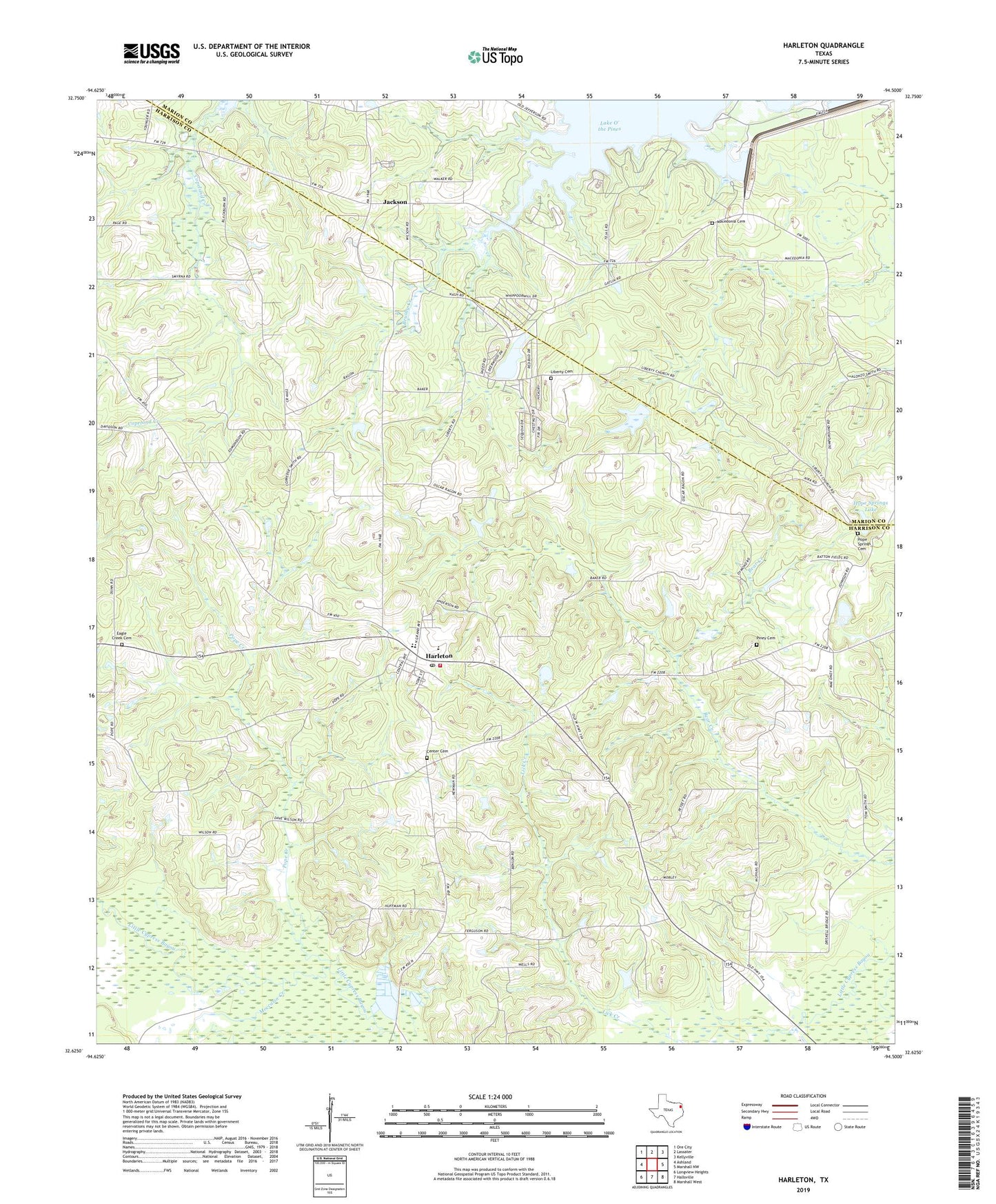
2019 topographic map quadrangle Harleton in the state of Texas. Scale: 1:24000. Based on the newly updated USGS 7.5' US Topo map series, this map is in the following counties: Harrison, Marion. The map contains contour data, water features, and other items you are used to seeing on USGS maps, but also has updated roads and other features. This is the next generation of topographic maps. Printed on high-quality waterproof paper with UV fade-resistant inks.
Quads adjacent to this one:
West: Ashland
Northwest: Ore City
North: Lassater
Northeast: Kellyville
East: Marshall NW
Southeast: Marshall West
South: Hallsville
Southwest: Longview Heights
Contains the following named places: Athey Church, Bear Springs Church, Brushy Creek, Brushy Creek Campground, Center Cemetery, Eagle Creek Cemetery, Ferrells Bridge Dam, Harleton, Harleton Division, Harleton Post Office, Harleton Volunteer Fire Department, Hope Springs Cemetery, Hope Springs Lake, Jackson, Jackson Community Building, Lake Deerwood, Lake Deerwood Estates Dam, Lakeside Park, Liberty Cemetery, Lodwick Church, Macedonia, Macedonia Cemetery, Moccasin Creek, Oak Grove Church, Piney Cemetery, Piney Church, Pope Creek, Smyrna Church, West Abutment Recreational Area, Whelan Gas Field, ZIP Code: 75651