MyTopo
Lassater Texas US Topo Map
Couldn't load pickup availability
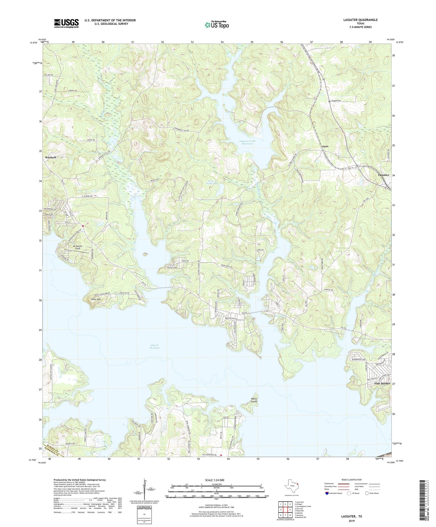
2022 topographic map quadrangle Lassater in the state of Texas. Scale: 1:24000. Based on the newly updated USGS 7.5' US Topo map series, this map is in the following counties: Marion, Harrison. The map contains contour data, water features, and other items you are used to seeing on USGS maps, but also has updated roads and other features. This is the next generation of topographic maps. Printed on high-quality waterproof paper with UV fade-resistant inks.
Quads adjacent to this one:
West: Ore City
Northwest: Lone Star
North: Avinger
Northeast: Cunningham Creek
East: Kellyville
Southeast: Marshall NW
South: Harleton
Southwest: Ashland
This map covers the same area as the classic USGS quad with code o32094g5.
Contains the following named places: Adams Chapel, Alley Creek, Alley Creek Park, Alley Creek Recreation Area, Arms Creek, Big Cypress Creek, Copeland Creek, Copeland Creek Recreation Area, Felix A Smith Lake, Felix A Smith Lake Dam, Hurricane Creek, Hurricane Creek Recreation Area, Jackson Volunteer Fire Department, Johnson Creek, Johnson Creek Dam, Johnson Creek Recreation Area, Johnson Creek Reservoir, Lake Ferrell Oil Field, Lake O' the Pines, Lake O' the Pines Division, Lassater, Lassater Gas Field, Locks Mountain, Lone Oak Church, McKenzie Field, Mims Chapel, Mims Volunteer Fire Department, Orrs, Pyland Cemetery, Robertson Boys Camp, Rock Springs, Victory, Warlock, Watts Island, Wilkes Powerplant, ZIP Code: 75630