MyTopo
Kellyville Texas US Topo Map
Couldn't load pickup availability
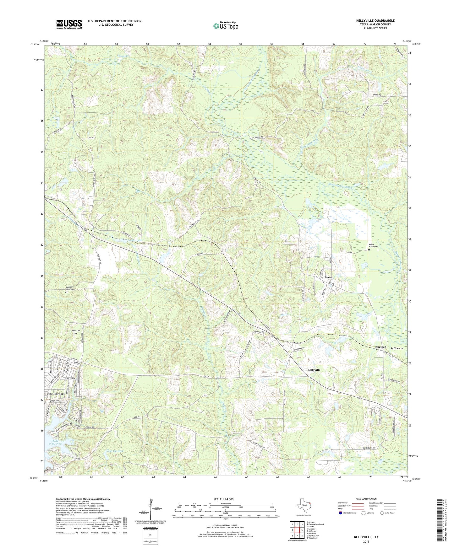
2022 topographic map quadrangle Kellyville in the state of Texas. Scale: 1:24000. Based on the newly updated USGS 7.5' US Topo map series, this map is in the following counties: Marion. The map contains contour data, water features, and other items you are used to seeing on USGS maps, but also has updated roads and other features. This is the next generation of topographic maps. Printed on high-quality waterproof paper with UV fade-resistant inks.
Quads adjacent to this one:
West: Lassater
Northwest: Avinger
North: Cunningham Creek
Northeast: Lanier
East: Jefferson
Southeast: Woodlawn
South: Marshall NW
Southwest: Harleton
This map covers the same area as the classic USGS quad with code o32094g4.
Contains the following named places: Beamer - Davis Cemetery, Berea, Buckhorn Creek Park, Burford, Cattail Creek, East Abutment Recreation Area, Jefferson Rural Academy, Kellyville, Kellyville Siding, Lake By-Heck, Mill Creek, Morning Star Church, Pine Harbor Census Designated Place, Sarber, Sarber Lake, Shady Grove Church, Valley Plains Cemetery, Webb Cemetery, White Oak, White Oak Creek