MyTopo
Harrisburg Texas US Topo Map
Couldn't load pickup availability
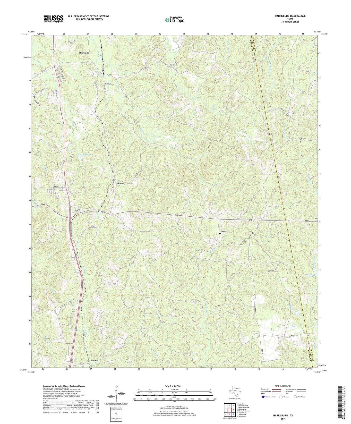
2019 topographic map quadrangle Harrisburg in the state of Texas. Scale: 1:24000. Based on the newly updated USGS 7.5' US Topo map series, this map is in the following counties: Jasper, Newton. The map contains contour data, water features, and other items you are used to seeing on USGS maps, but also has updated roads and other features. This is the next generation of topographic maps. Printed on high-quality waterproof paper with UV fade-resistant inks.
Quads adjacent to this one:
West: McGee Bend
Northwest: Buck Bay
North: Pineland South
Northeast: Hurricane Creek
East: Weeks Settlement
Southeast: Jamestown
South: Jasper East
Southwest: Jasper West
Contains the following named places: Bridge Creek, Browndell, Collins, Frisby Cemetery, Hales Lake, Hales Lake Dam, Hardy Creek, Harrisburg, Horton, KJAS-FM (Jasper), KWYX-FM (Jasper), Mill Creek Church, Roundtree Lake, Roundtree Lake Dam, Seay Lake, Seay Lake Dam