MyTopo
Hurricane Creek Texas US Topo Map
Couldn't load pickup availability
Also explore the Hurricane Creek Forest Service Topo of this same quad for updated USFS data
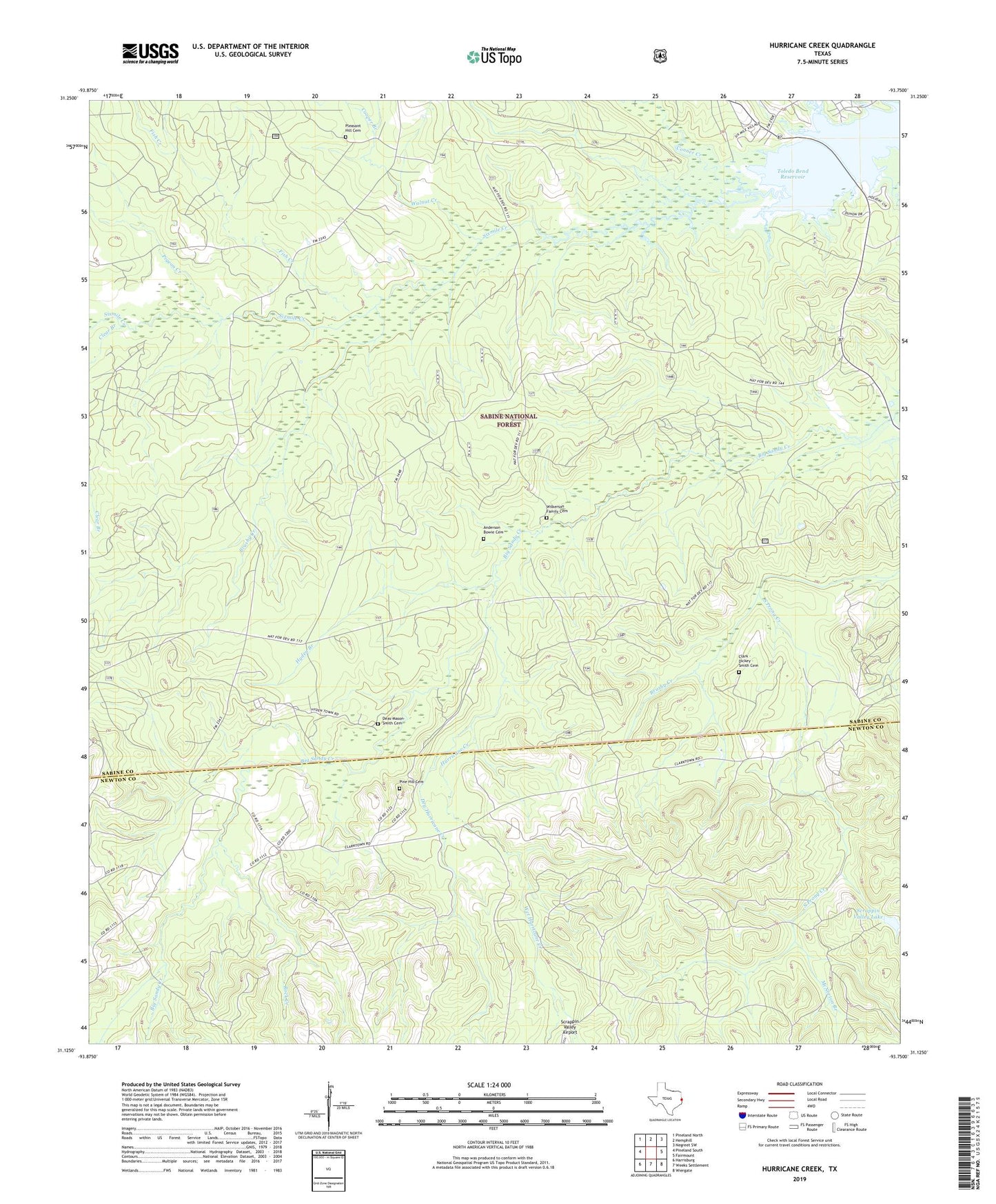
2022 topographic map quadrangle Hurricane Creek in the state of Texas. Scale: 1:24000. Based on the newly updated USGS 7.5' US Topo map series, this map is in the following counties: Sabine, Newton. The map contains contour data, water features, and other items you are used to seeing on USGS maps, but also has updated roads and other features. This is the next generation of topographic maps. Printed on high-quality waterproof paper with UV fade-resistant inks.
Quads adjacent to this one:
West: Pineland South
Northwest: Pineland North
North: Hemphill
Northeast: Negreet SW
East: Fairmount
Southeast: Wiergate
South: Weeks Settlement
Southwest: Harrisburg
This map covers the same area as the classic USGS quad with code o31093b7.
Contains the following named places: Anderson Bowie Cemetery, Brushy Creek, Clark - Clarkton Cemetery, Clarktown, Conner Creek, Cooper Branch, Deas-Mason-Smith Cemetery, Dry Hurricane Creek, Fish Creek, Friendship Church, Hurricane Creek, Hyden Branch, Lick Branch, Mason, McNorton Branch, Pigeon Creek, Pine Hill Cemetery, Pine Hill Church, Pleasant Hill Cemetery, Rice Creek, Rock Creek, Sandy Branch, Scrappin Valley Lake, Scrappin Valley Lake Dam, Scrapping Valley, Sixmile Creek, Walnut Creek, Wet Hurricane Creek, Wilkerson Family Cemetery