MyTopo
Weeks Settlement Texas US Topo Map
Couldn't load pickup availability
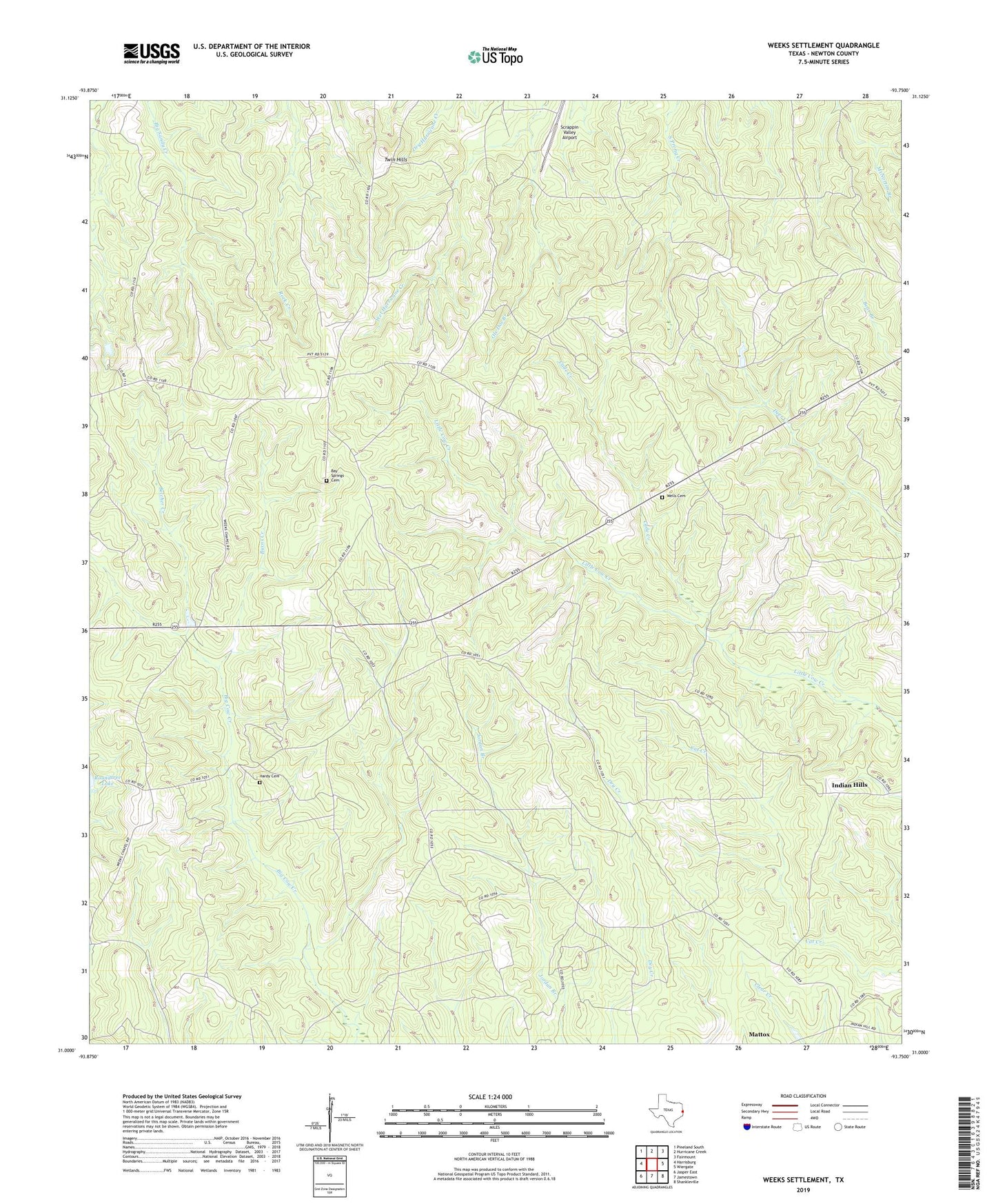
2022 topographic map quadrangle Weeks Settlement in the state of Texas. Scale: 1:24000. Based on the newly updated USGS 7.5' US Topo map series, this map is in the following counties: Newton. The map contains contour data, water features, and other items you are used to seeing on USGS maps, but also has updated roads and other features. This is the next generation of topographic maps. Printed on high-quality waterproof paper with UV fade-resistant inks.
Quads adjacent to this one:
West: Harrisburg
Northwest: Pineland South
North: Hurricane Creek
Northeast: Fairmount
East: Wiergate
Southeast: Shankleville
South: Jamestown
Southwest: Jasper East
This map covers the same area as the classic USGS quad with code o31093a7.
Contains the following named places: Bay Springs Cemetery, Beef Trail Campground, Belcher Creek, Burns Creek, Cade Creek, Crenshaw Branch, Hardy Cemetery, Indian Hills, Mayflower Lookout, Ole Doc Branch, Scrappin Valley Airport, Twin Hills, Weeks Chapel, Weeks Settlement, Wells Cemetery, ZIP Code: 75977