MyTopo
Jamestown Texas US Topo Map
Couldn't load pickup availability
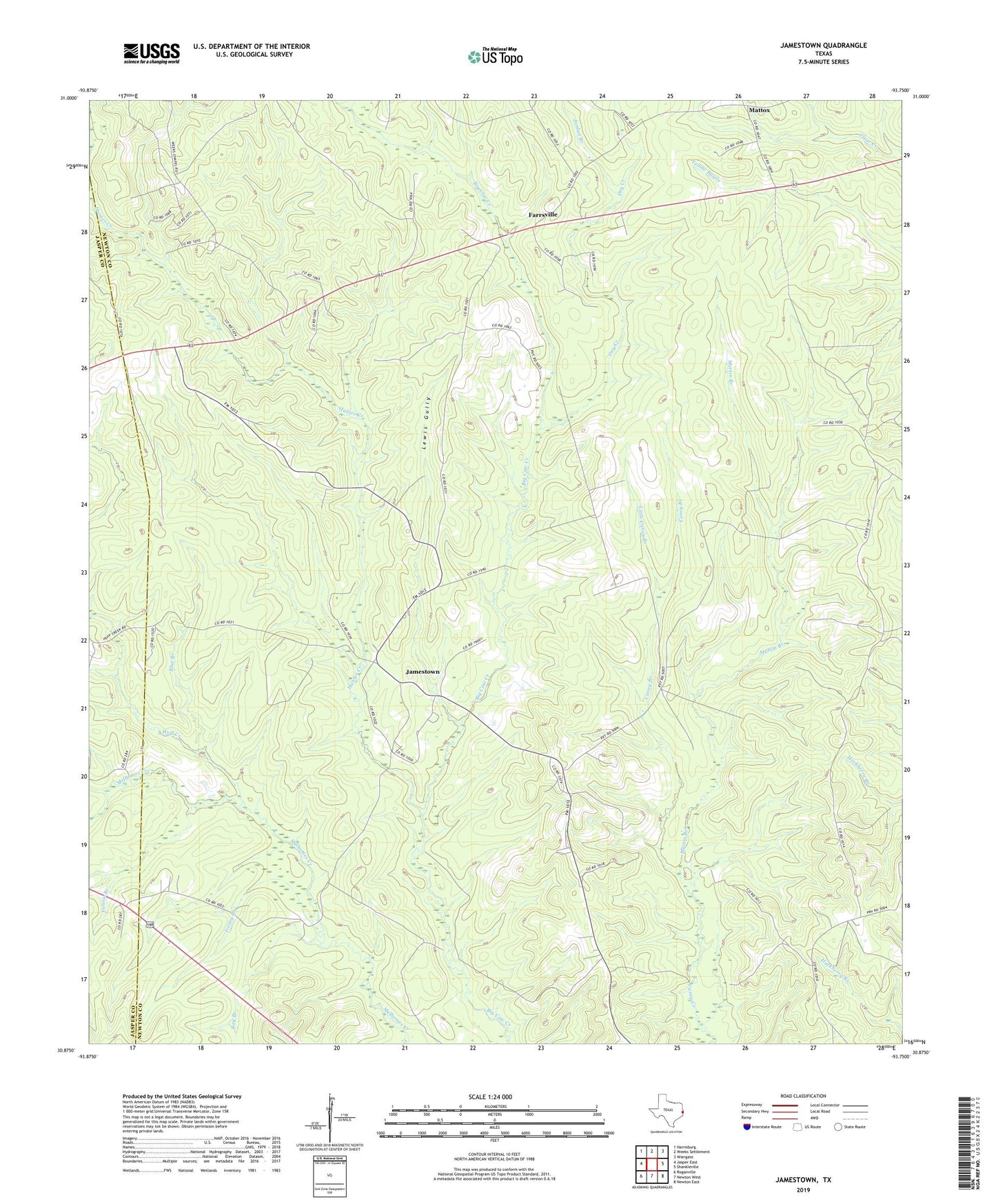
2022 topographic map quadrangle Jamestown in the state of Texas. Scale: 1:24000. Based on the newly updated USGS 7.5' US Topo map series, this map is in the following counties: Newton, Jasper. The map contains contour data, water features, and other items you are used to seeing on USGS maps, but also has updated roads and other features. This is the next generation of topographic maps. Printed on high-quality waterproof paper with UV fade-resistant inks.
Quads adjacent to this one:
West: Jasper East
Northwest: Harrisburg
North: Weeks Settlement
Northeast: Wiergate
East: Shankleville
Southeast: Newton East
South: Newton West
Southwest: Roganville
This map covers the same area as the classic USGS quad with code o30093h7.
Contains the following named places: Bay Branch, Blue Branch, Caney Branch, Dry Creek, Fannie Branch, Farrs Chapel, Farrsville, Huff Creek, Huff Creek Church, Irving Branch, Jamestown, Jordan Branch, Lewis Gully, Little Caney Branch, Martin Branch, Mattox, Pinehill Church, Pleasant Hill Church