MyTopo
Hawkins Texas US Topo Map
Couldn't load pickup availability
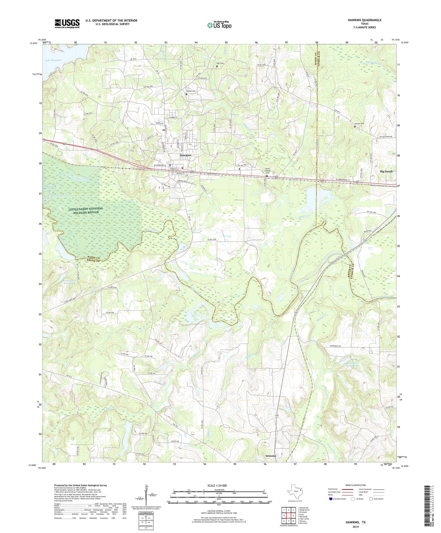
2019 topographic map quadrangle Hawkins in the state of Texas. Scale: 1:24000. Based on the newly updated USGS 7.5' US Topo map series, this map is in the following counties: Smith, Wood, Upshur. The map contains contour data, water features, and other items you are used to seeing on USGS maps, but also has updated roads and other features. This is the next generation of topographic maps. Printed on high-quality waterproof paper with UV fade-resistant inks.
Quads adjacent to this one:
West: Crow
Northwest: Hainesville
North: Shady Grove
Northeast: Pritchett
East: Big Sandy
Southeast: Starrville
South: Winona
Southwest: Tyler North
Contains the following named places: Bethlehem Church, Born Branch, Bradford Lake, Brown Lake Number 2, Brown Lake Number 2 Dam, Champion Emergency Medical Service, City of Hawkins, East Mill Creek, Fairmont Branch Library, Fouke-Hawkins High School, Glade Creek, Haney Cemetery, Harris Creek, Hawkins, Hawkins Camp, Hawkins City Cemetery, Hawkins City Hall, Hawkins High School, Hawkins Oil Field, Hawkins Police Department, Hawkins Post Office, Hawkins Volunteer Fire Department, Holly Tree Dam, Holly Tree Lake, Jarvis Christian College, Jarvis College Cemetery, Kay Cemetery, Kay Creek, KLTV-TV (Tyler), KTYL-FM (Tyler), KVNE-FM (Tyler), Lake Clear, Liberty Church, Lynn Creek, Mount Olive Church, Paron Church, Pine Hurst Farm, Pinehurst Farm Lake Dam, Pinehurst Farms Lake, Rogers Creek, Simpson Creek, Smith Chapel, Varnon Cemetery, Waters Bluff Church, Wells Park, White Oak Creek, Winona Division, Winona Industrial High School, Wood County Constable's Office Precinct 3