MyTopo
Heel Fly Draw Texas US Topo Map
Couldn't load pickup availability
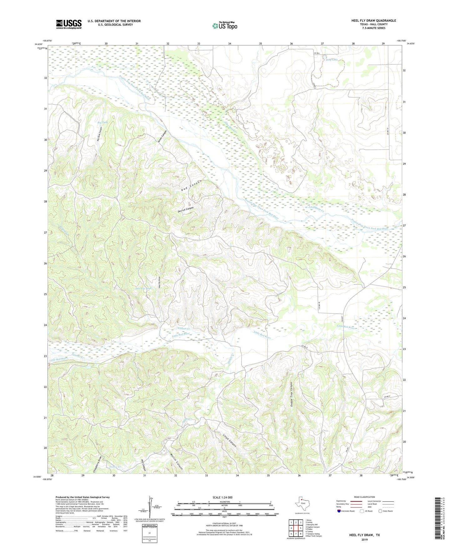
2019 topographic map quadrangle Heel Fly Draw in the state of Texas. Scale: 1:24000. Based on the newly updated USGS 7.5' US Topo map series, this map is in the following counties: Hall. The map contains contour data, water features, and other items you are used to seeing on USGS maps, but also has updated roads and other features. This is the next generation of topographic maps. Printed on high-quality waterproof paper with UV fade-resistant inks.
Quads adjacent to this one:
West: Hughes Canyon
Northwest: Brice
North: Lesley
Northeast: Memphis NW
East: Plaska
Southeast: Blue Tank Canyon
South: Tampico Siding
Southwest: Turkey
Contains the following named places: Big Tank, Big Tank Canyon, Chinaberry Draw, Dad Canyon, Deep Lake, Derrick Canyon, Heel Fly Draw, Heel Fly Tank, Hill Canyon, John Mann Creek, Jones Canyon, Lloyd Canyon, Lower Wildcat Windmill, Mullin Canyon, Oxbow Creek, Oxbow Ranch, Oxbow Trap Canyon, Polecat Creek, Upper Wildcat Windmill, Wildcat Creek