MyTopo
Hughes Canyon Texas US Topo Map
Couldn't load pickup availability
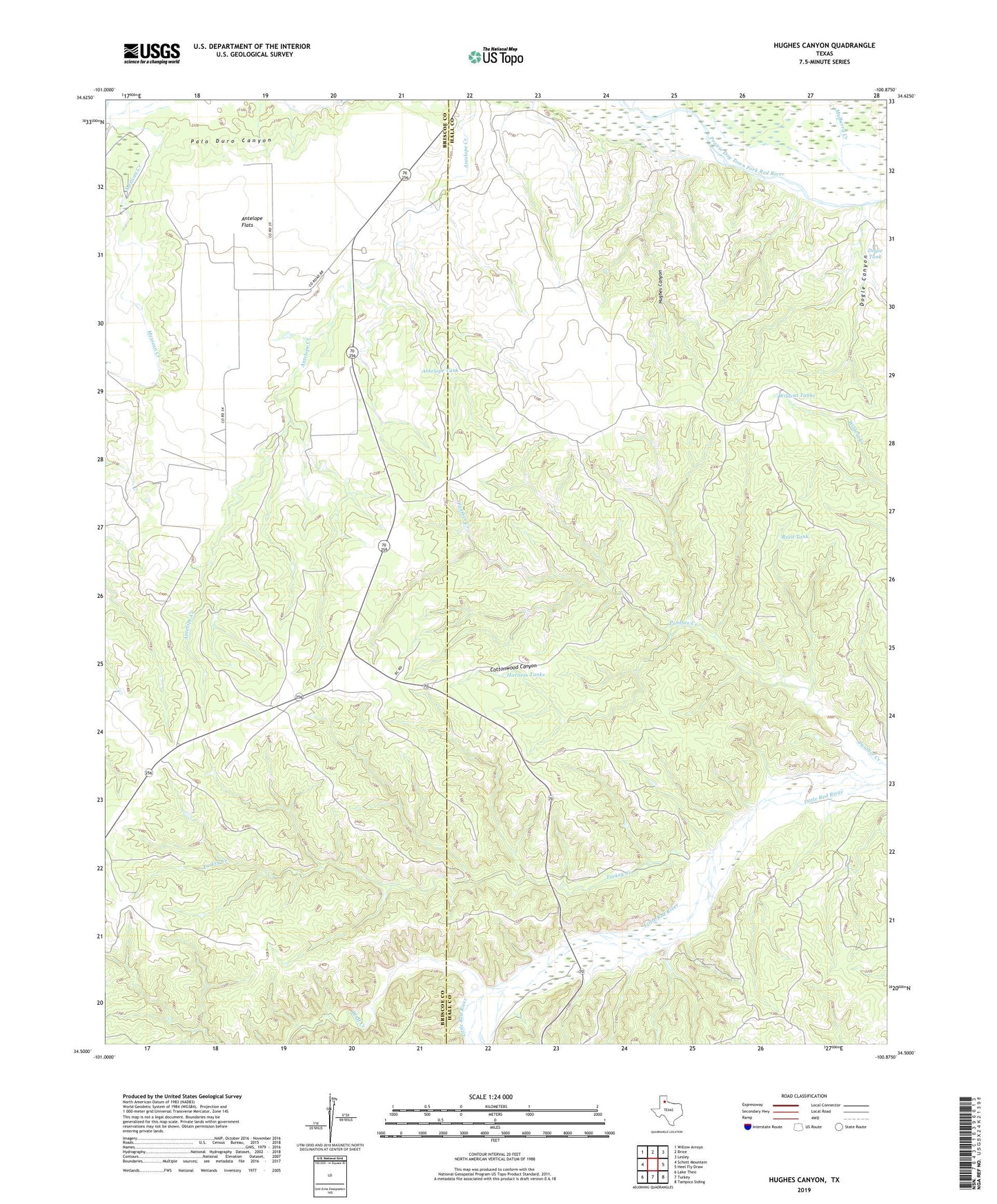
2022 topographic map quadrangle Hughes Canyon in the state of Texas. Scale: 1:24000. Based on the newly updated USGS 7.5' US Topo map series, this map is in the following counties: Hall, Briscoe. The map contains contour data, water features, and other items you are used to seeing on USGS maps, but also has updated roads and other features. This is the next generation of topographic maps. Printed on high-quality waterproof paper with UV fade-resistant inks.
Quads adjacent to this one:
West: Schott Mountain
Northwest: Willow Arroyo
North: Brice
Northeast: Lesley
East: Heel Fly Draw
Southeast: Tampico Siding
South: Turkey
Southwest: Lake Theo
This map covers the same area as the classic USGS quad with code o34100e8.
Contains the following named places: Antelope Flats, Antelope Tank, Bitter Creek, Bluff Creek, Cottonwood Canyon, Dogie Tank, Dogle Canyon, Harness Tanks, Hughes Canyon, Lazy U Ranch, Mexican Creek, Mulberry Creek, Panther Creek, Reed Tank, Shoe Bar Ranch, Turkey Creek, Wildcat Tanks