MyTopo
Helms West Well Texas US Topo Map
Couldn't load pickup availability
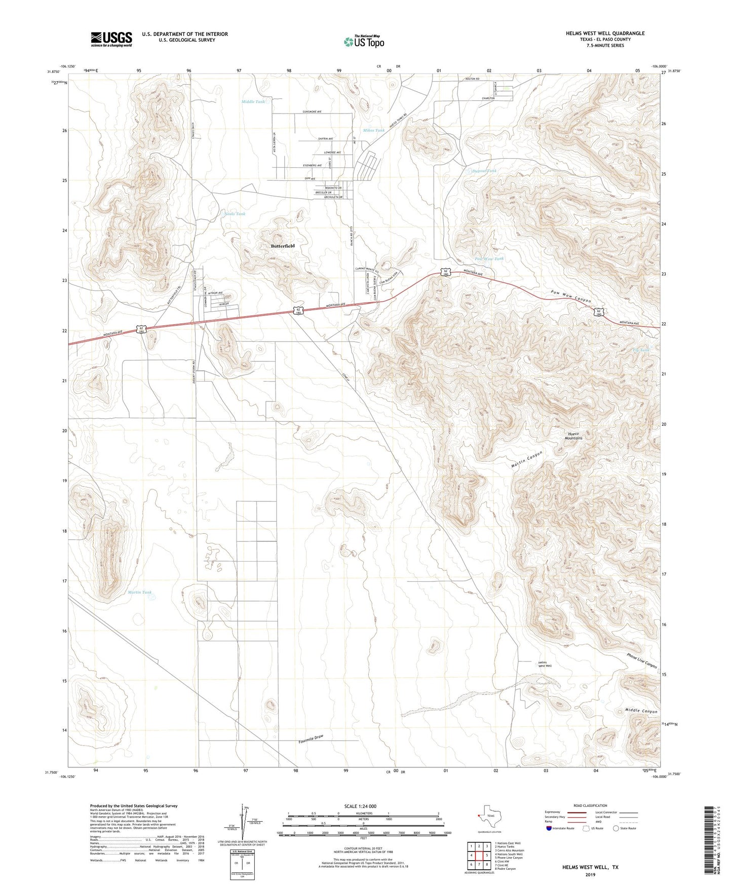
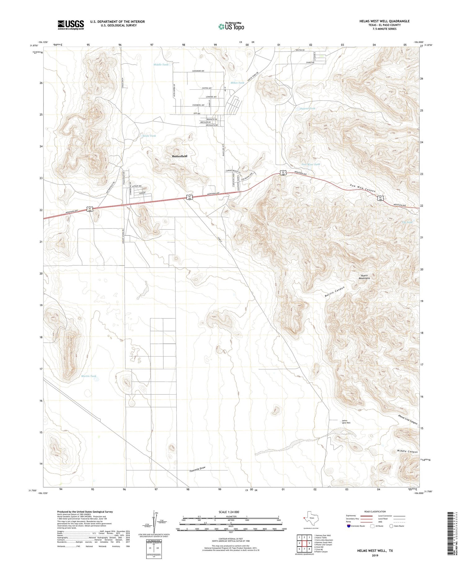
2019 topographic map quadrangle Helms West Well in the state of Texas. Scale: 1:24000. Based on the newly updated USGS 7.5' US Topo map series, this map is in the following counties: El Paso. The map contains contour data, water features, and other items you are used to seeing on USGS maps, but also has updated roads and other features. This is the next generation of topographic maps. Printed on high-quality waterproof paper with UV fade-resistant inks.
Quads adjacent to this one:
West: Nations South Well
Northwest: Nations East Well
North: Hueco Tanks
Northeast: Cerro Alto Mountain
East: Phone Line Canyon
Southeast: Padre Canyon
South: Clint NE
Southwest: Clint NW
Contains the following named places: Butterfield, Butterfield Census Designated Place, Butterfield City Number 1 Colonia, Butterfield City Number 2 Colonia, Butterfield City Number 3 Colonia, Butterfield City Number 4 Colonia, Dugout Tank, Fly Tank, Helms West Well, Hueco Mountain Estates Number 9 Colonia, Martin Canyon, Martin Tank, Middle Canyon, Middle Tank, Mikes Tank, Neals Tank, Phone Line Canyon, Pow Wow Canyon, Pow Wow Tank