MyTopo
Hico Texas US Topo Map
Couldn't load pickup availability
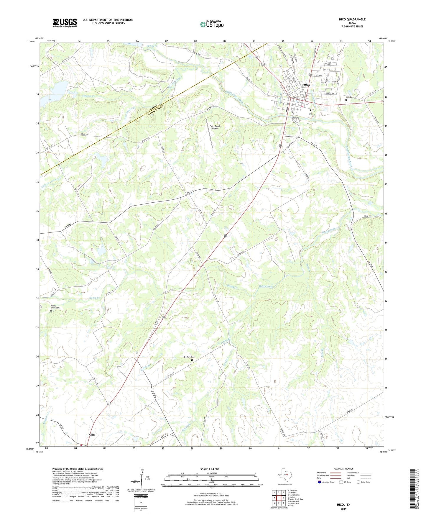
2019 topographic map quadrangle Hico in the state of Texas. Scale: 1:24000. Based on the newly updated USGS 7.5' US Topo map series, this map is in the following counties: Hamilton, Erath. The map contains contour data, water features, and other items you are used to seeing on USGS maps, but also has updated roads and other features. This is the next generation of topographic maps. Printed on high-quality waterproof paper with UV fade-resistant inks.
Quads adjacent to this one:
West: Carlton
Northwest: Alexander
North: Clairette
Northeast: Camp Branch
East: Spring Creek Gap
Southeast: Fairy
South: Eidson Lake
Southwest: Gentrys Mill
Contains the following named places: Blue Bonnet Country Club, Carlton Volunteer Fire Department, City of Hico, Dry Fork, Dry Fork Cemetery, Gilmore Creek, Grubbs Branch, Hamilton Emergency Medical Service Station 2, Hico, Hico Cemetery, Hico City Hall, Hico Police Department, Hico Post Office, Hico Volunteer Fire Department, Honey Creek Cemetery, Jacks Hollow Branch, Little Gilmore Creek, Long Branch, Olin, Putty Ranch Airport, Soil Conservation Service Site 25 Dam, Soil Conservation Service Site 25 Reservoir, Soil Conservation Service Site 27 Dam, Soil Conservation Service Site 27 Reservoir, Soil Conservation Service Site 28 Dam, Soil Conservation Service Site 28 Reservoir, Spring Creek, Turkey Branch, ZIP Code: 76457