MyTopo
Clairette Texas US Topo Map
Couldn't load pickup availability
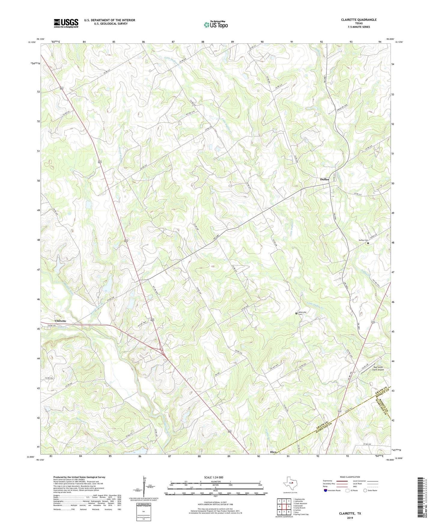
2022 topographic map quadrangle Clairette in the state of Texas. Scale: 1:24000. Based on the newly updated USGS 7.5' US Topo map series, this map is in the following counties: Erath, Hamilton, Bosque. The map contains contour data, water features, and other items you are used to seeing on USGS maps, but also has updated roads and other features. This is the next generation of topographic maps. Printed on high-quality waterproof paper with UV fade-resistant inks.
Quads adjacent to this one:
West: Alexander
Northwest: Stephenville
North: Johnsville
Northeast: Chalk Mountain
East: Camp Branch
Southeast: Spring Creek Gap
South: Hico
Southwest: Carlton
This map covers the same area as the classic USGS quad with code o32098a1.
Contains the following named places: Byrd Cemetery, Clairette, Duffau, Duffau Cemetery, Duffau-Clairette Division, Green Creek, McSwain Field, Millerville Cemetery, Ray Smith Farm Airport, Round Hole Branch, Soil Conservation Service Site 24 Dam, Soil Conservation Service Site 24 Reservoir, Soil Conservation Service Site 26 Dam, Soil Conservation Service Site 26 Reservoir, Spring Creek, Turkey Branch