MyTopo
Spring Creek Gap Texas US Topo Map
Couldn't load pickup availability
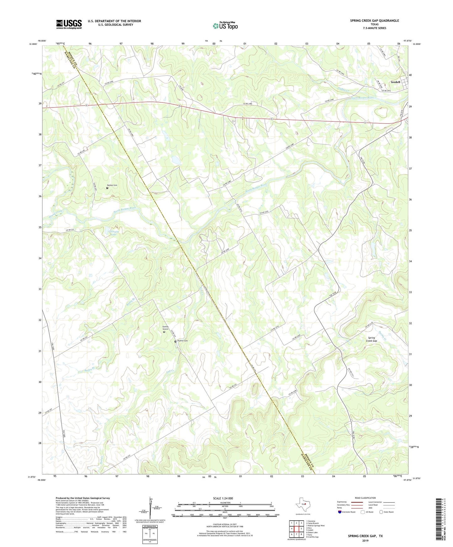
2022 topographic map quadrangle Spring Creek Gap in the state of Texas. Scale: 1:24000. Based on the newly updated USGS 7.5' US Topo map series, this map is in the following counties: Bosque, Hamilton. The map contains contour data, water features, and other items you are used to seeing on USGS maps, but also has updated roads and other features. This is the next generation of topographic maps. Printed on high-quality waterproof paper with UV fade-resistant inks.
Quads adjacent to this one:
West: Hico
Northwest: Clairette
North: Camp Branch
Northeast: Walnut Springs West
East: Iredell
Southeast: Cranfills Gap
South: Fairy
Southwest: Eidson Lake
This map covers the same area as the classic USGS quad with code o31097h8.
Contains the following named places: Bailey Branch, Barbee Cemetery, Duffau Creek, Fall Creek, Fillingim Lake, Fillingim Lake Dam, Honey Creek, Proffitt Cemetery, Spring Creek Gap, Stanley Graves