MyTopo
Alexander Texas US Topo Map
Couldn't load pickup availability
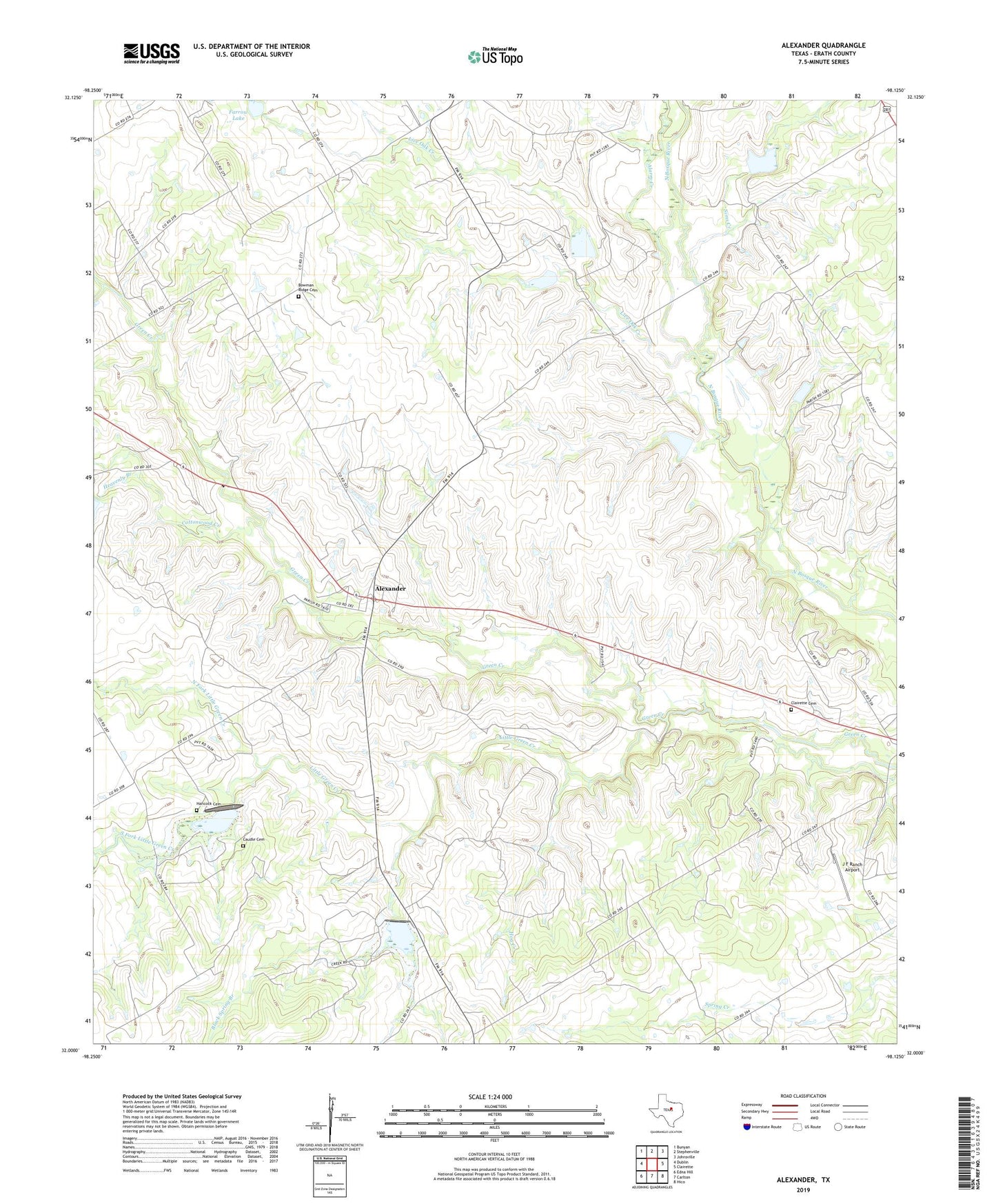
2022 topographic map quadrangle Alexander in the state of Texas. Scale: 1:24000. Based on the newly updated USGS 7.5' US Topo map series, this map is in the following counties: Erath. The map contains contour data, water features, and other items you are used to seeing on USGS maps, but also has updated roads and other features. This is the next generation of topographic maps. Printed on high-quality waterproof paper with UV fade-resistant inks.
Quads adjacent to this one:
West: Dublin
Northwest: Bunyan
North: Stephenville
Northeast: Johnsville
East: Clairette
Southeast: Hico
South: Carlton
Southwest: Edna Hill
This map covers the same area as the classic USGS quad with code o32098a2.
Contains the following named places: Alarm Creek, Alexander, Black Spring Branch, Bowman Ridge, Bowman Ridge Cemetery, Caudle Cemetery, Clairette Cemetery, Community Chapel, Cottonwood Creek, Farrow Lake, Farrow Lake Dam, Green Creek Dam Number 10, Green Creek Dam Number 12, Green Creek Dam Number 13, Hancock Cemetery, Heavenly Branch, Hog Creek, J F Ranch Airport, Little Green Creek, Live Oak Creek, North Fork Little Green Creek, Sims Creek, Soil Conservation Service Site 12 Dam, Soil Conservation Service Site 12 Reservoir, Soil Conservation Service Site 13 Dam, Soil Conservation Service Site 13 Reservoir, Soil Conservation Service Site 19 Dam, Soil Conservation Service Site 19 Reservoir, Soil Conservation Service Site 20 Dam, Soil Conservation Service Site 20 Reservoir, Soil Conservation Service Site 21 Dam, Soil Conservation Service Site 21 Reservoir, Soil Conservation Service Site 22 Dam, Soil Conservation Service Site 22 Reservoir, Soil Conservation Service Site 23 Dam, Soil Conservation Service Site 23 Reservoir, South Fork Little Green Creek