MyTopo
Hilburn Texas US Topo Map
Couldn't load pickup availability
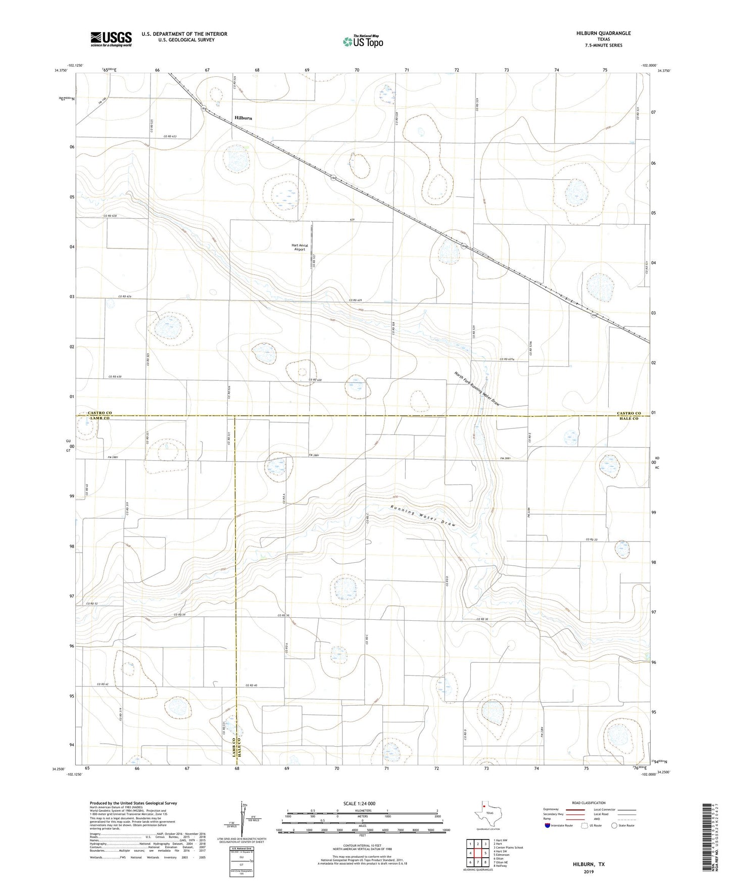
2022 topographic map quadrangle Hilburn in the state of Texas. Scale: 1:24000. Based on the newly updated USGS 7.5' US Topo map series, this map is in the following counties: Castro, Hale, Lamb. The map contains contour data, water features, and other items you are used to seeing on USGS maps, but also has updated roads and other features. This is the next generation of topographic maps. Printed on high-quality waterproof paper with UV fade-resistant inks.
Quads adjacent to this one:
West: Hart SW
Northwest: Hart NW
North: Hart
Northeast: Center Plains School
East: Edmonson
Southeast: Halfway
South: Olton NE
Southwest: Olton
This map covers the same area as the classic USGS quad with code o34102c1.
Contains the following named places: Grisham, Hart Aerial Airport, Hilburn, North Fork Running Water Draw, Soil Conservation Service Site 2 Dam, Soil Conservation Service Site 2 Reservoir, Valley View Church