MyTopo
Hog Mountain Texas US Topo Map
Couldn't load pickup availability
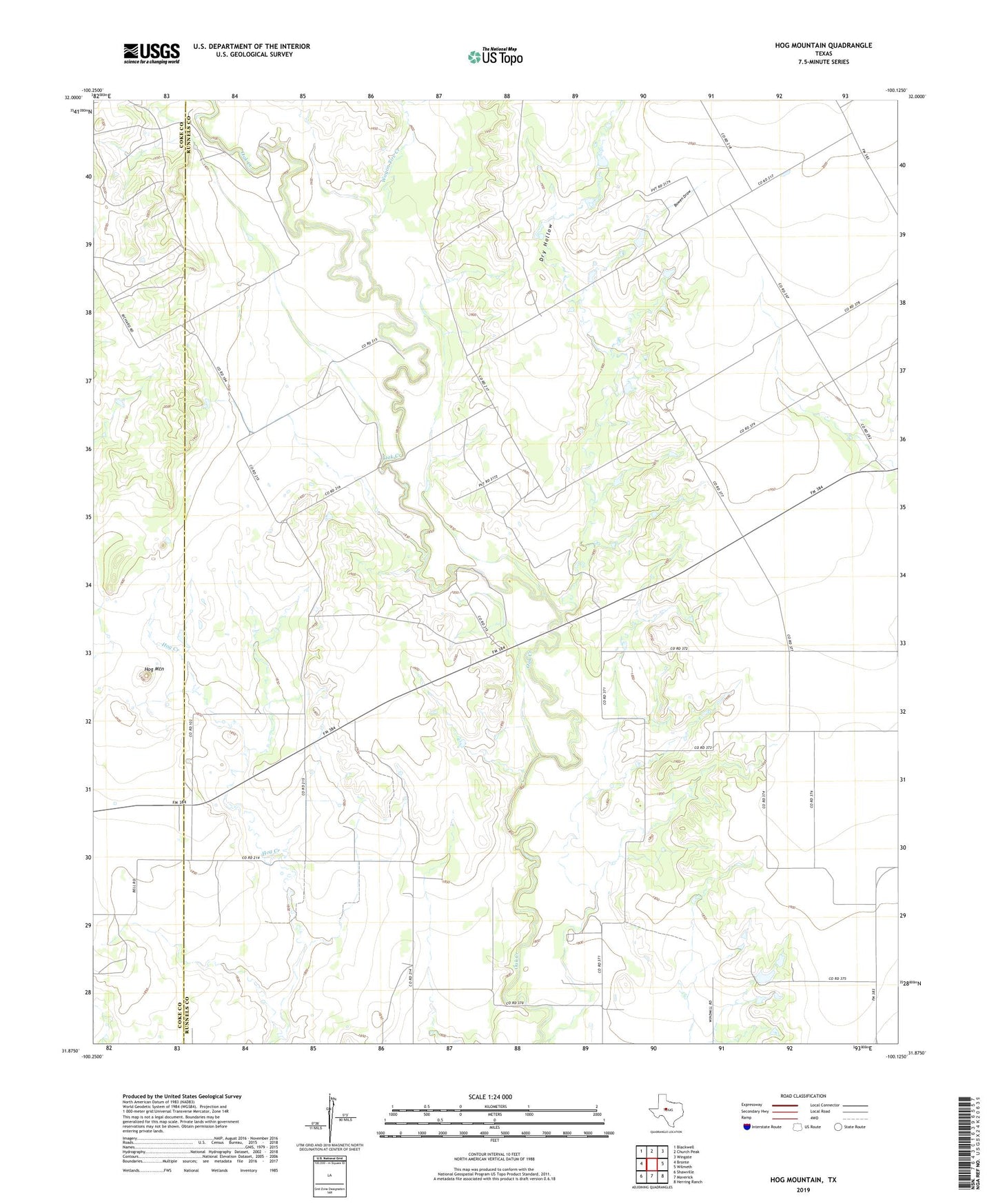
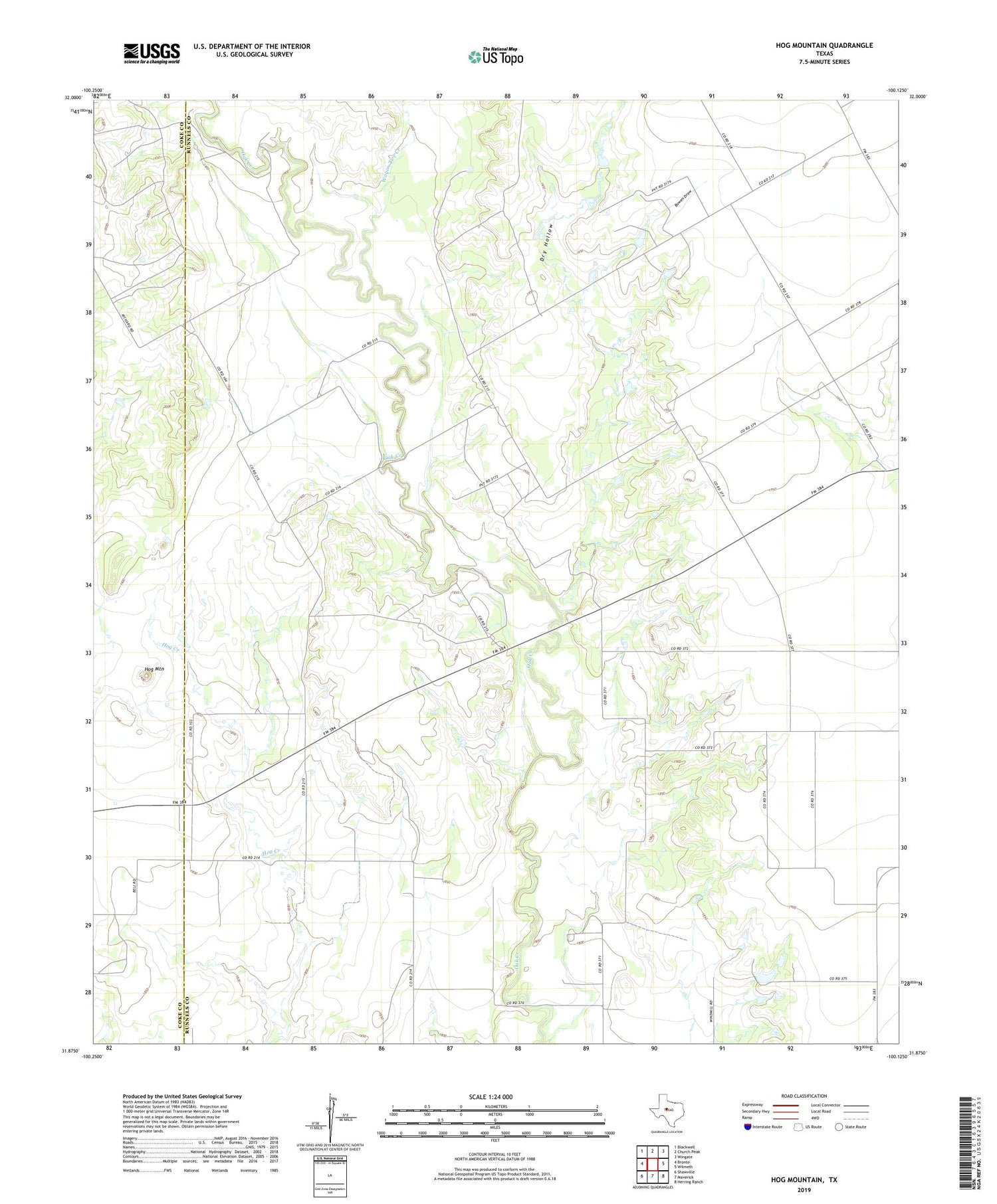
2019 topographic map quadrangle Hog Mountain in the state of Texas. Scale: 1:24000. Based on the newly updated USGS 7.5' US Topo map series, this map is in the following counties: Runnels, Coke. The map contains contour data, water features, and other items you are used to seeing on USGS maps, but also has updated roads and other features. This is the next generation of topographic maps. Printed on high-quality waterproof paper with UV fade-resistant inks.
Quads adjacent to this one:
West: Bronte
Northwest: Blackwell
North: Church Peak
Northeast: Wingate
East: Wilmeth
Southeast: Herring Ranch
South: Maverick
Southwest: Shawville
Contains the following named places: Bowen Draw, Dry Hollow, Hog Mountain, Marie, Wagon Tire Creek