MyTopo
Honey Grove Texas US Topo Map
Couldn't load pickup availability
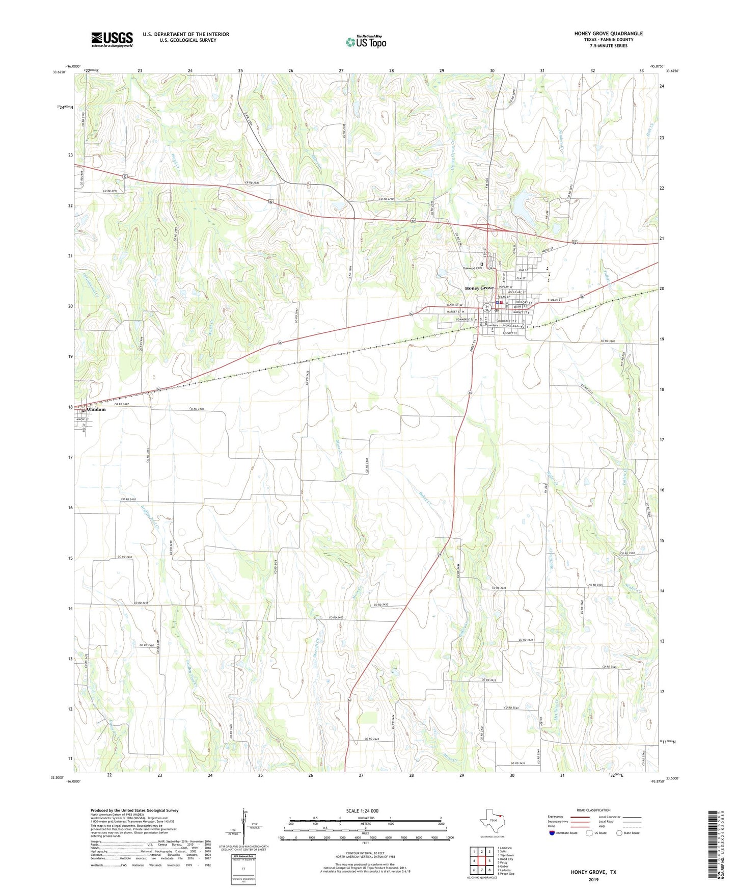
2019 topographic map quadrangle Honey Grove in the state of Texas. Scale: 1:24000. Based on the newly updated USGS 7.5' US Topo map series, this map is in the following counties: Fannin. The map contains contour data, water features, and other items you are used to seeing on USGS maps, but also has updated roads and other features. This is the next generation of topographic maps. Printed on high-quality waterproof paper with UV fade-resistant inks.
Quads adjacent to this one:
West: Dodd City
Northwest: Lamasco
North: Selfs
Northeast: Tigertown
East: Petty
Southeast: Pecan Gap
South: Ladonia
Southwest: Gober
Contains the following named places: Bralley Pool Cemetery, Bralley Pool School, Cedar Hill Cemetery, City of Honey Grove, Eight Street United Methodist Church, Fannin County Constable's Office Precinct 3, First Baptist Church, Floyd Thicket Cemetery, Hall-Voyer Foundation Exhibits Hall, Honey Grove, Honey Grove City Hall, Honey Grove City Lake, Honey Grove City Lake Dam, Honey Grove Division, Honey Grove First Responders, Honey Grove High School, Honey Grove Police Department, Honey Grove Post Office, Honey Grove Volunteer Fire Department, JLS Farms Airport, Johnston Cemetery, Landmark Missionary Baptist Church, McCraw Chapel, McCraw Chapel School, McCraws Chapel Cemetery, Moss Creek, Oakwood Cemetery, Rock Point School, Saint Lukes Lutheran Church, Thomas and Katherine Trout House, Tollett Creek, Town of Windom, Windom, Windom City Hall, Windom Post Office, ZIP Codes: 75446, 75492