MyTopo
Selfs Texas US Topo Map
Couldn't load pickup availability
Also explore the Selfs Forest Service Topo of this same quad for updated USFS data
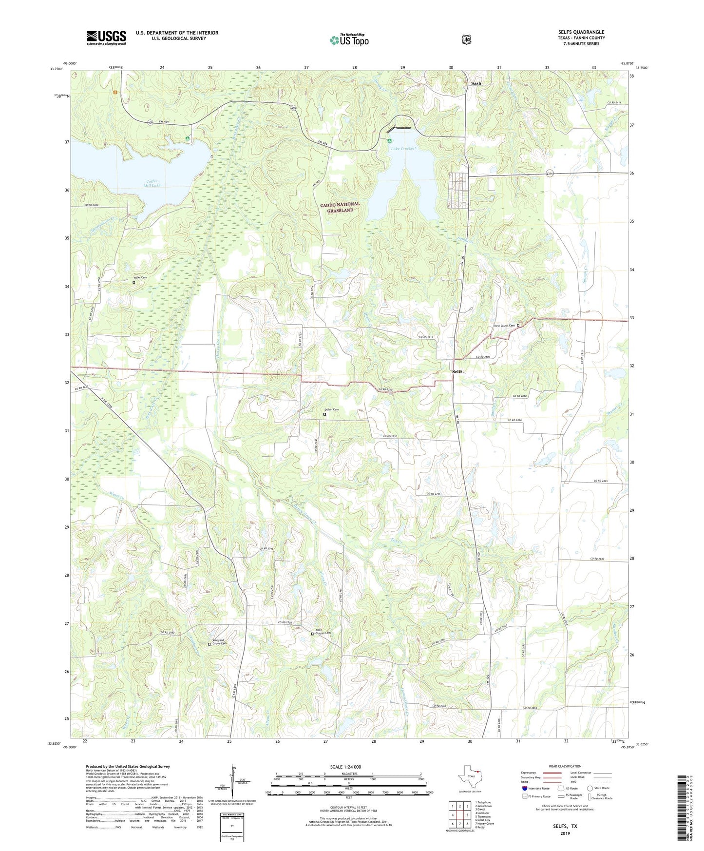
2022 topographic map quadrangle Selfs in the state of Texas. Scale: 1:24000. Based on the newly updated USGS 7.5' US Topo map series, this map is in the following counties: Fannin. The map contains contour data, water features, and other items you are used to seeing on USGS maps, but also has updated roads and other features. This is the next generation of topographic maps. Printed on high-quality waterproof paper with UV fade-resistant inks.
Quads adjacent to this one:
West: Lamasco
Northwest: Telephone
North: Monkstown
Northeast: Direct
East: Tigertown
Southeast: Petty
South: Honey Grove
Southwest: Dodd City
This map covers the same area as the classic USGS quad with code o33095f8.
Contains the following named places: Allen - Morgan Cemetery, Allen Chapel School, Allen Point, Allens Chapel, Allens Chapel Cemetery, Allens Creek, Allens Point Cemetery, Caddo National Grassland, Caddo Work Center, Coffee Mill Creek, Coffee Mill Creek Dam, Coffee Mill Creek Lake, Coffee Mill Lake, Cravens Cemetery, Dixon Creek, East Coffee Mill Recreation Site, Fox Creek, Green Chapel School, Gum Springs School, Honey Grove Creek, Lake Crockett, Lake Davy Crockett, Lake Davy Crockett Dam, Lake Davy Crockett Recreation Site, New Salem Cemetery, Oliver's Chapel Cemetery, Page Wilkerson Cemetery, Saint Andrews Church, Saint James Church, Sash, Selfs, Shiloh Cemetery, Spoonamore Creek, Texas No Name Number 35 Dam, Vineyard Grove Cemetery, Ward Creek, Wilks Cemetery, Yoakum Creek