MyTopo
Tigertown Texas US Topo Map
Couldn't load pickup availability
Also explore the Tigertown Forest Service Topo of this same quad for updated USFS data
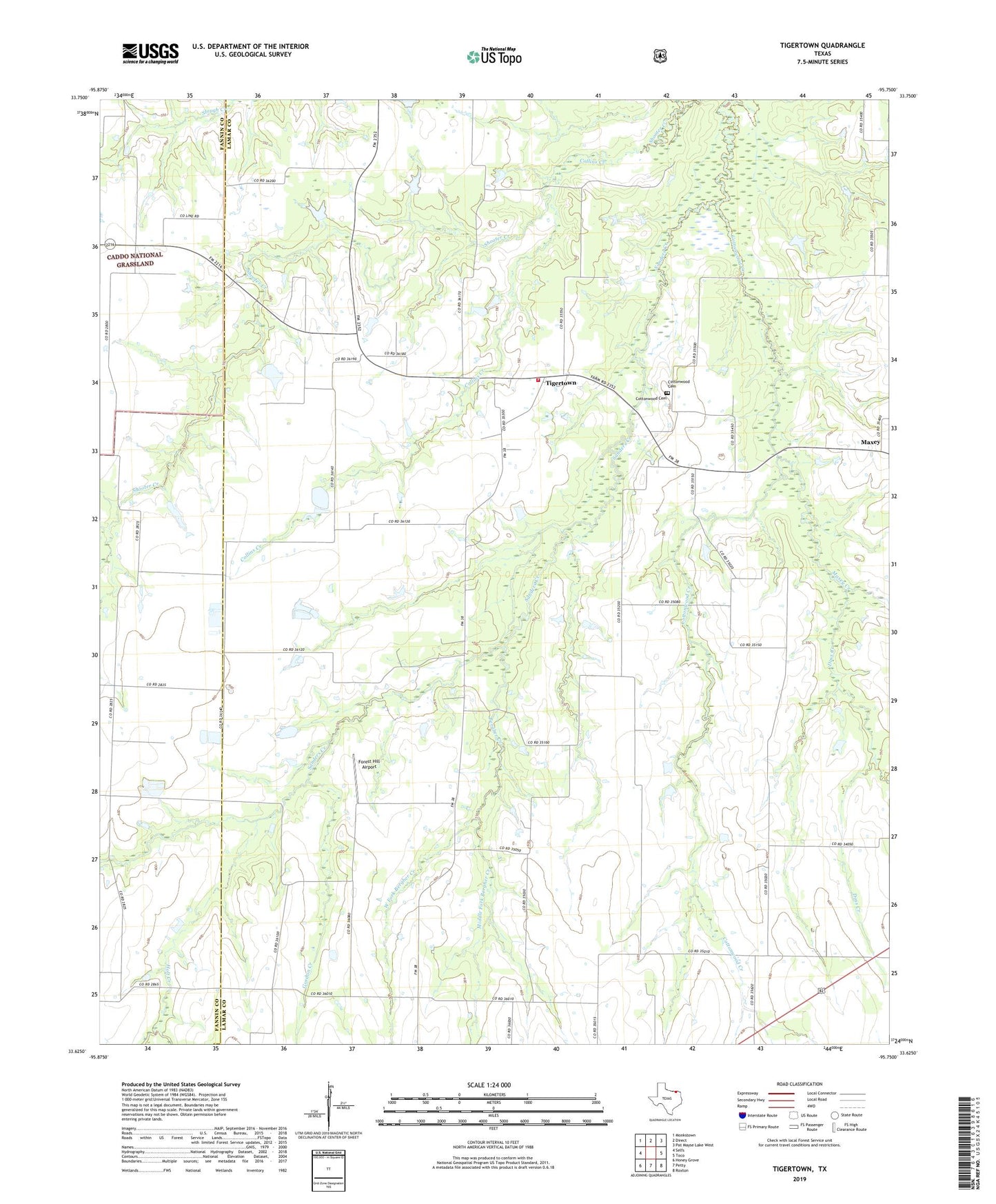
2022 topographic map quadrangle Tigertown in the state of Texas. Scale: 1:24000. Based on the newly updated USGS 7.5' US Topo map series, this map is in the following counties: Lamar, Fannin. The map contains contour data, water features, and other items you are used to seeing on USGS maps, but also has updated roads and other features. This is the next generation of topographic maps. Printed on high-quality waterproof paper with UV fade-resistant inks.
Quads adjacent to this one:
West: Selfs
Northwest: Monkstown
North: Direct
Northeast: Pat Mayse Lake West
East: Toco
Southeast: Roxton
South: Petty
Southwest: Honey Grove
This map covers the same area as the classic USGS quad with code o33095f7.
Contains the following named places: Bergher Creek, Collins Creek, Cottonwood Cemetery, Cottonwood Creek, Cottonwood School, Doss Creek, Felix Stephens Lake, Felix Stephens Lake Dam, Forest Hill, Forest Hill Airport, Forest Hill Church, Forest Hill School, Gordon Creek, Holt Creek, Maxey, Maxey Creek, Michigan Prairie School, Middle Fork Bergher Creek, Pleasant Hill School, Robinson Lake Number 1, Robinson Lake Number 1 Dam, Tigertown, Tigertown Volunteer Fire Department, Titus School, West Fork Bergher Creek, West Fork Cottonwood Creek, West Lamar School