MyTopo
Hopper Draw West Texas US Topo Map
Couldn't load pickup availability
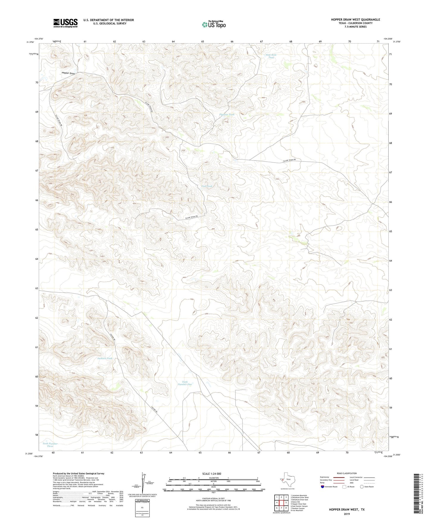
2019 topographic map quadrangle Hopper Draw West in the state of Texas. Scale: 1:24000. Based on the newly updated USGS 7.5' US Topo map series, this map is in the following counties: Culberson. The map contains contour data, water features, and other items you are used to seeing on USGS maps, but also has updated roads and other features. This is the next generation of topographic maps. Printed on high-quality waterproof paper with UV fade-resistant inks.
Quads adjacent to this one:
West: Dome Hill
Northwest: Loneman Mountain
North: Dellahunt Draw West
Northeast: Dellahunt Draw East
East: Hopper Draw East
Southeast: Iron Mountain
South: Panther Canyon
Southwest: East Hunter Canyon
Contains the following named places: Hopper Windmill, Jackson Tank, Ort, Pipeline Tank, Red Windmill, Sink Hole Tank, Tank Number One, Tank Number Three, Veal Tank