MyTopo
Dome Hill Texas US Topo Map
Couldn't load pickup availability
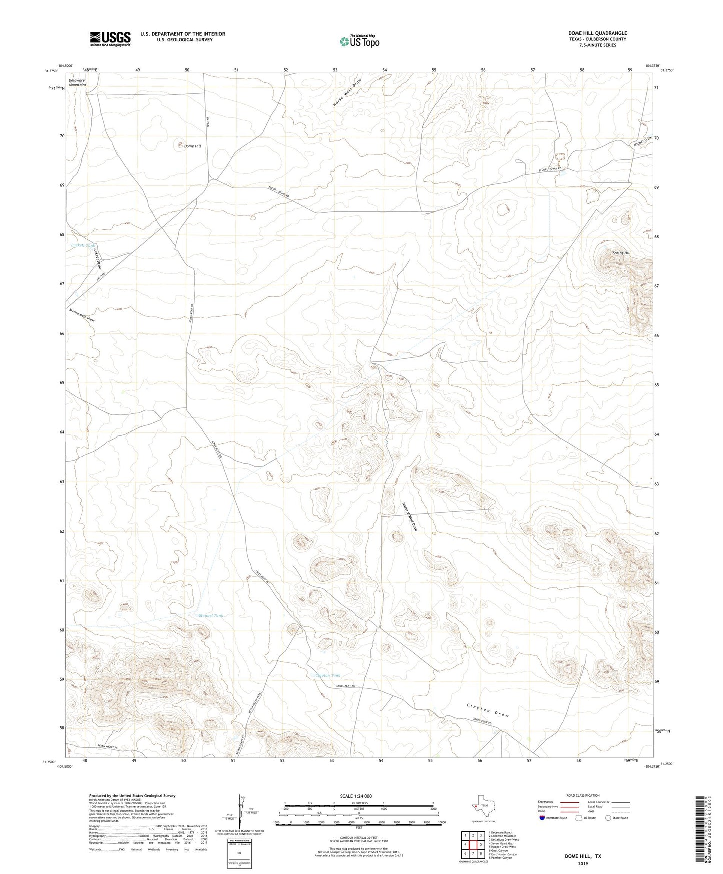
2022 topographic map quadrangle Dome Hill in the state of Texas. Scale: 1:24000. Based on the newly updated USGS 7.5' US Topo map series, this map is in the following counties: Culberson. The map contains contour data, water features, and other items you are used to seeing on USGS maps, but also has updated roads and other features. This is the next generation of topographic maps. Printed on high-quality waterproof paper with UV fade-resistant inks.
Quads adjacent to this one:
West: Seven Heart Gap
Northwest: Delaware Ranch
North: Loneman Mountain
Northeast: Dellahunt Draw West
East: Hopper Draw West
Southeast: Panther Canyon
South: East Hunter Canyon
Southwest: Goat Canyon
This map covers the same area as the classic USGS quad with code o31104c4.
Contains the following named places: Bronco Mule Draw, Clayton Tank, Dome Hill, Farrell Windmill, Jones Ranch, Luckett Draw, Luckett Tank, Manuel Tank, Mutt and Jeff Windmills, Natural Well Draw, Rock House Plant, Schilling Windmill, Spring Hill