MyTopo
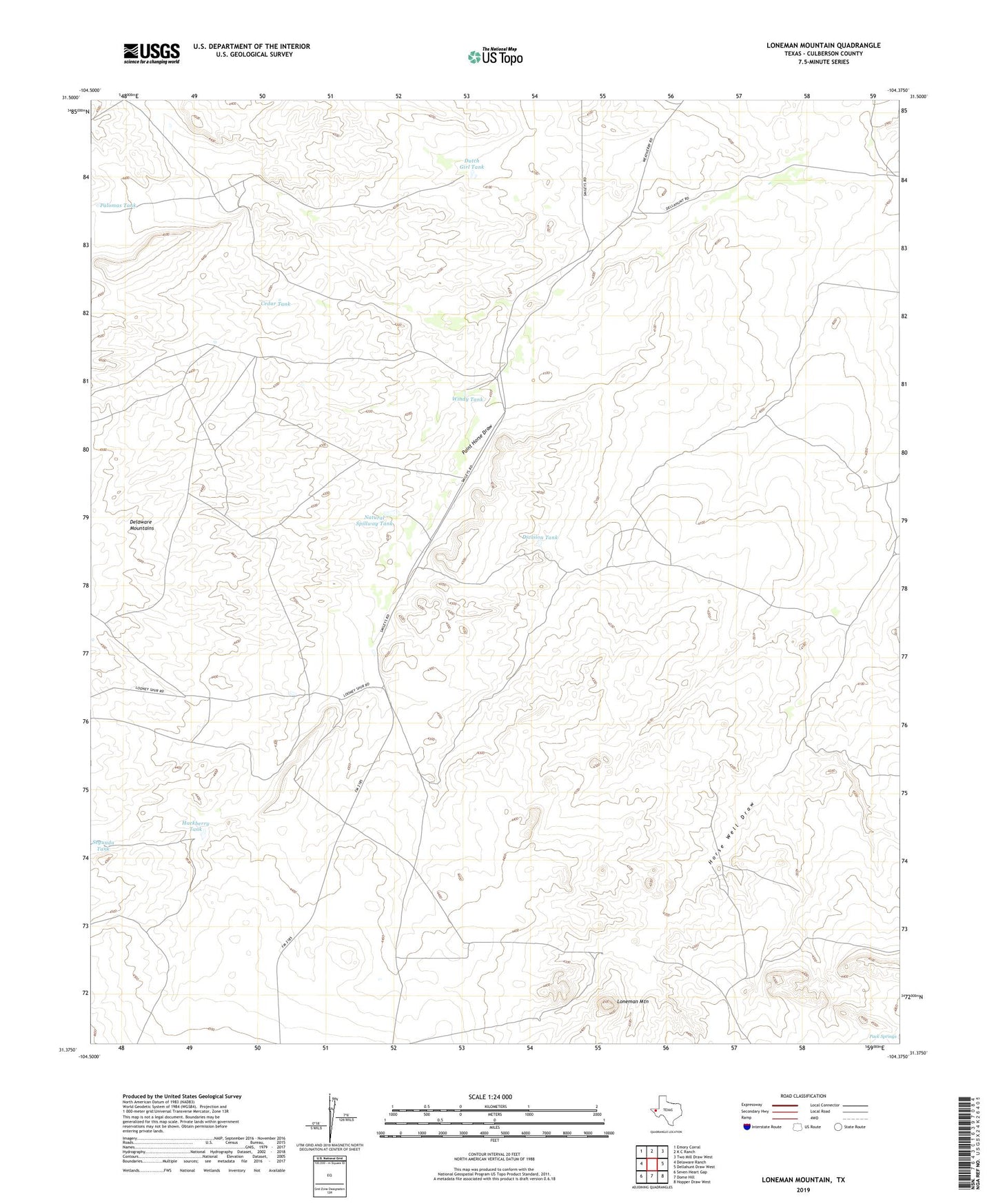
Loneman Mountain Texas US Topo Map
Couldn't load pickup availability
2022 topographic map quadrangle Loneman Mountain in the state of Texas. Scale: 1:24000. Based on the newly updated USGS 7.5' US Topo map series, this map is in the following counties: Culberson. The map contains contour data, water features, and other items you are used to seeing on USGS maps, but also has updated roads and other features. This is the next generation of topographic maps. Printed on high-quality waterproof paper with UV fade-resistant inks.
Quads adjacent to this one:
West: Delaware Ranch
Northwest: Emory Corral
North: K C Ranch
Northeast: Two Mill Draw West
East: Dellahunt Draw West
Southeast: Hopper Draw West
South: Dome Hill
Southwest: Seven Heart Gap
This map covers the same area as the classic USGS quad with code o31104d4.
Contains the following named places: Brooks Well, Cedar Tank, Division Tank, Dutch Girl Tank, East Windmill, Hackberry Tank, Horse Wells, Loneman Mountain, Looney Ranch, Middle Well, Natural Spillway Tank, Pack Springs, Palomas Tank, South Windmill, Windy Tank